You are here: Home > Network List > IW - Intermountain West Stations List
> Station MOOW Moose Ponds, Wyoming, USA > Earthquake Result Viewer
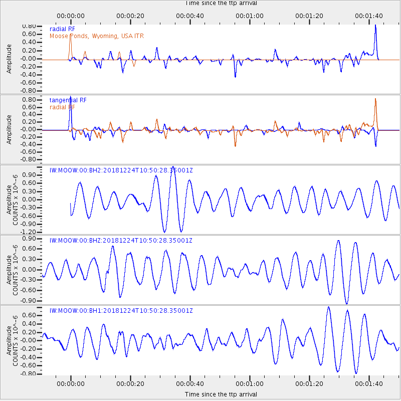
MOOW Moose Ponds, Wyoming, USA - Earthquake Result Viewer
*The percent match for this event was below the threshold and hence no stack was calculated.
| Earthquake location: |
Komandorskiye Ostrova Region |
| Earthquake latitude/longitude: |
54.5/164.2 |
| Earthquake time(UTC): |
2018/12/24 (358) 10:41:39 GMT |
| Earthquake Depth: |
10 km |
| Earthquake Magnitude: |
5.4 Mww |
| Earthquake Catalog/Contributor: |
NEIC PDE/us |
|
| Network: |
IW Intermountain West |
| Station: |
MOOW Moose Ponds, Wyoming, USA |
| Lat/Lon: |
43.75 N/110.74 W |
| Elevation: |
2128 m |
|
| Distance: |
53.4 deg |
| Az: |
64.067 deg |
| Baz: |
313.626 deg |
| Ray Param: |
$rayparam |
*The percent match for this event was below the threshold and hence was not used in the summary stack. |
|
| Radial Match: |
55.91645 % |
| Radial Bump: |
400 |
| Transverse Match: |
47.426575 % |
| Transverse Bump: |
368 |
| SOD ConfigId: |
3201911 |
| Insert Time: |
2019-01-07 10:47:06.583 +0000 |
| GWidth: |
2.5 |
| Max Bumps: |
400 |
| Tol: |
0.001 |
|
Signal To Noise
| Channel | StoN | STA | LTA |
| IW:MOOW:00:BHZ:20181224T10:50:28.35001Z | 0.6772657 | 1.5274844E-7 | 2.2553695E-7 |
| IW:MOOW:00:BH1:20181224T10:50:28.35001Z | 0.65251046 | 2.2656815E-7 | 3.472253E-7 |
| IW:MOOW:00:BH2:20181224T10:50:28.35001Z | 2.6856925 | 8.4001164E-7 | 3.1277284E-7 |
| Arrivals |
| Ps | |
| PpPs | |
| PsPs/PpSs | |


