You are here: Home > Network List > TA - USArray Transportable Network (new EarthScope stations) Stations List
> Station L33A Hoskins, NE, USA > Earthquake Result Viewer
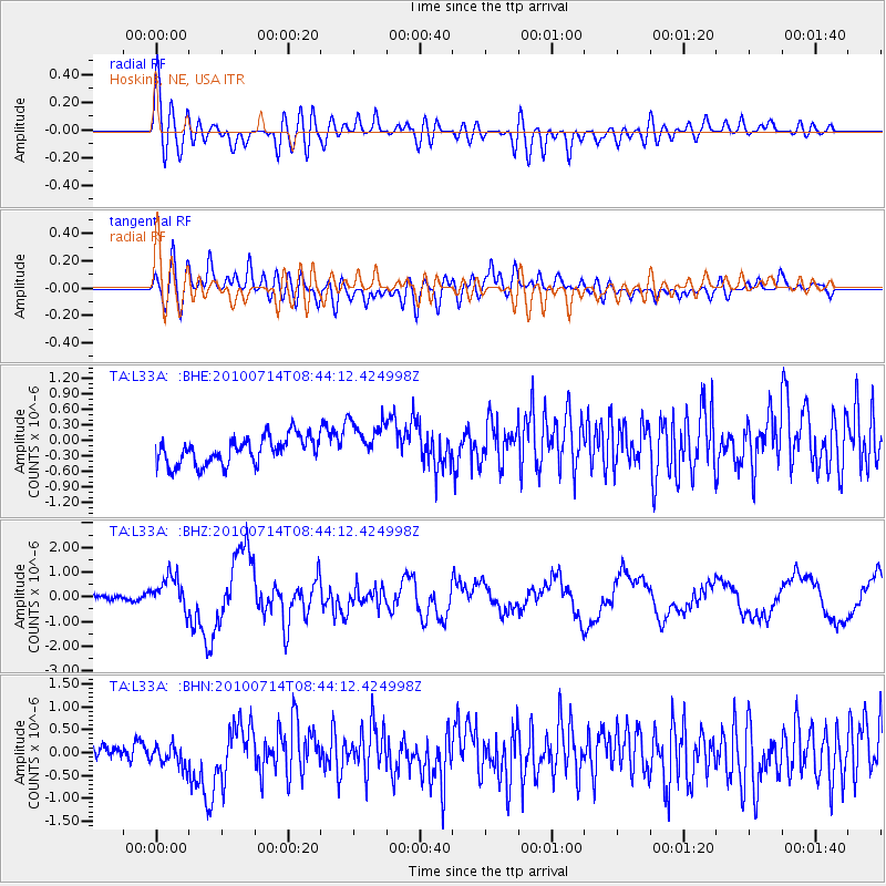
L33A Hoskins, NE, USA - Earthquake Result Viewer
*The percent match for this event was below the threshold and hence no stack was calculated.
| Earthquake location: |
Near Coast Of Central Chile |
| Earthquake latitude/longitude: |
-38.1/-73.3 |
| Earthquake time(UTC): |
2010/07/14 (195) 08:32:21 GMT |
| Earthquake Depth: |
22 km |
| Earthquake Magnitude: |
5.9 MB, 6.5 MS, 6.6 MW, 6.5 MW |
| Earthquake Catalog/Contributor: |
WHDF/NEIC |
|
| Network: |
TA USArray Transportable Network (new EarthScope stations) |
| Station: |
L33A Hoskins, NE, USA |
| Lat/Lon: |
42.17 N/97.27 W |
| Elevation: |
556 m |
|
| Distance: |
82.8 deg |
| Az: |
342.281 deg |
| Baz: |
161.148 deg |
| Ray Param: |
$rayparam |
*The percent match for this event was below the threshold and hence was not used in the summary stack. |
|
| Radial Match: |
69.11932 % |
| Radial Bump: |
400 |
| Transverse Match: |
59.566578 % |
| Transverse Bump: |
400 |
| SOD ConfigId: |
319893 |
| Insert Time: |
2011-01-05 03:32:47.754 +0000 |
| GWidth: |
2.5 |
| Max Bumps: |
400 |
| Tol: |
0.001 |
|
Signal To Noise
| Channel | StoN | STA | LTA |
| TA:L33A: :BHZ:20100714T08:44:12.424998Z | 6.219018 | 6.984796E-7 | 1.1231349E-7 |
| TA:L33A: :BHN:20100714T08:44:12.424998Z | 1.7143093 | 2.6208653E-7 | 1.5288171E-7 |
| TA:L33A: :BHE:20100714T08:44:12.424998Z | 1.6783824 | 4.4274975E-7 | 2.637955E-7 |
| Arrivals |
| Ps | |
| PpPs | |
| PsPs/PpSs | |


