You are here: Home > Network List > US - United States National Seismic Network Stations List
> Station MSO Missoula, Montana, USA > Earthquake Result Viewer
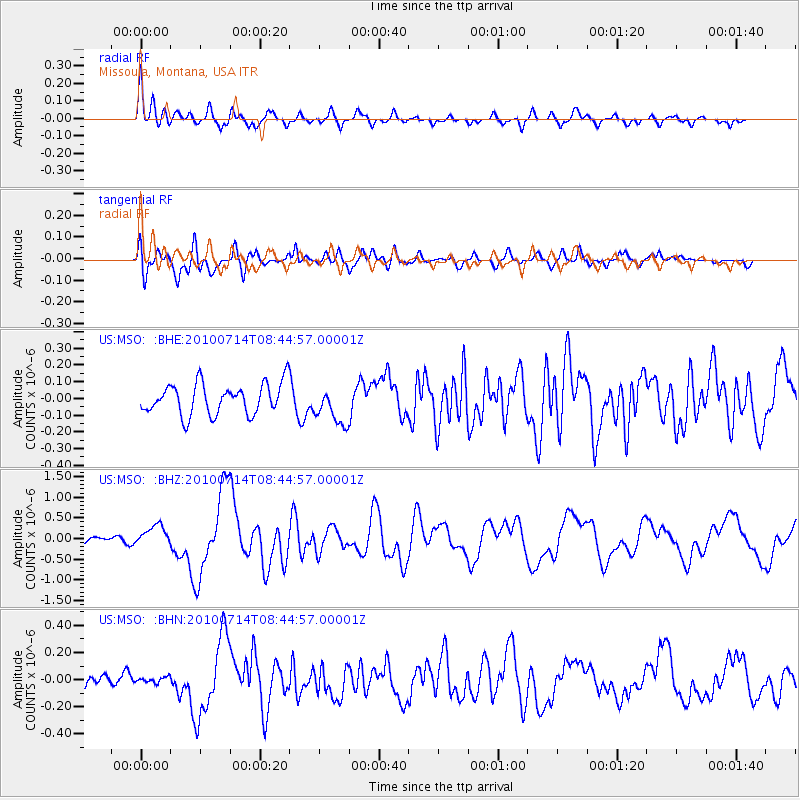
MSO Missoula, Montana, USA - Earthquake Result Viewer
*The percent match for this event was below the threshold and hence no stack was calculated.
| Earthquake location: |
Near Coast Of Central Chile |
| Earthquake latitude/longitude: |
-38.1/-73.3 |
| Earthquake time(UTC): |
2010/07/14 (195) 08:32:21 GMT |
| Earthquake Depth: |
22 km |
| Earthquake Magnitude: |
5.9 MB, 6.5 MS, 6.6 MW, 6.5 MW |
| Earthquake Catalog/Contributor: |
WHDF/NEIC |
|
| Network: |
US United States National Seismic Network |
| Station: |
MSO Missoula, Montana, USA |
| Lat/Lon: |
46.83 N/113.94 W |
| Elevation: |
1264 m |
|
| Distance: |
92.0 deg |
| Az: |
333.424 deg |
| Baz: |
149.05 deg |
| Ray Param: |
$rayparam |
*The percent match for this event was below the threshold and hence was not used in the summary stack. |
|
| Radial Match: |
75.93161 % |
| Radial Bump: |
400 |
| Transverse Match: |
62.087772 % |
| Transverse Bump: |
400 |
| SOD ConfigId: |
319893 |
| Insert Time: |
2011-01-05 03:35:35.522 +0000 |
| GWidth: |
2.5 |
| Max Bumps: |
400 |
| Tol: |
0.001 |
|
Signal To Noise
| Channel | StoN | STA | LTA |
| US:MSO: :BHZ:20100714T08:44:57.00001Z | 3.3438258 | 2.5533575E-7 | 7.6360365E-8 |
| US:MSO: :BHN:20100714T08:44:57.00001Z | 0.25390553 | 2.1027075E-8 | 8.281456E-8 |
| US:MSO: :BHE:20100714T08:44:57.00001Z | 1.2284818 | 1.13113664E-7 | 9.207598E-8 |
| Arrivals |
| Ps | |
| PpPs | |
| PsPs/PpSs | |


