You are here: Home > Network List > US - United States National Seismic Network Stations List
> Station BOZ Bozeman, Montana, USA > Earthquake Result Viewer
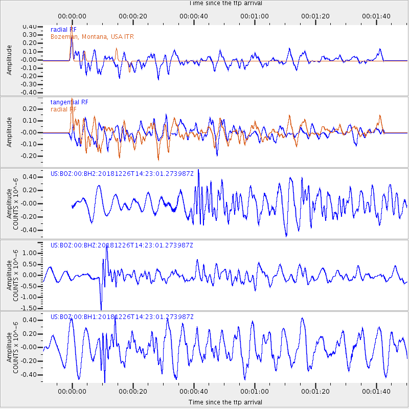
BOZ Bozeman, Montana, USA - Earthquake Result Viewer
*The percent match for this event was below the threshold and hence no stack was calculated.
| Earthquake location: |
Tonga Islands |
| Earthquake latitude/longitude: |
-17.2/-173.6 |
| Earthquake time(UTC): |
2018/12/26 (360) 14:11:21 GMT |
| Earthquake Depth: |
163 km |
| Earthquake Magnitude: |
6.0 Mi |
| Earthquake Catalog/Contributor: |
NEIC PDE/pt |
|
| Network: |
US United States National Seismic Network |
| Station: |
BOZ Bozeman, Montana, USA |
| Lat/Lon: |
45.65 N/111.63 W |
| Elevation: |
1589 m |
|
| Distance: |
83.9 deg |
| Az: |
38.515 deg |
| Baz: |
238.071 deg |
| Ray Param: |
$rayparam |
*The percent match for this event was below the threshold and hence was not used in the summary stack. |
|
| Radial Match: |
77.35338 % |
| Radial Bump: |
400 |
| Transverse Match: |
56.534073 % |
| Transverse Bump: |
400 |
| SOD ConfigId: |
3201911 |
| Insert Time: |
2019-01-09 14:21:38.689 +0000 |
| GWidth: |
2.5 |
| Max Bumps: |
400 |
| Tol: |
0.001 |
|
Signal To Noise
| Channel | StoN | STA | LTA |
| US:BOZ:00:BHZ:20181226T14:23:01.273987Z | 0.49544504 | 8.751708E-8 | 1.7664337E-7 |
| US:BOZ:00:BH1:20181226T14:23:01.273987Z | 3.14464 | 3.0268515E-7 | 9.625431E-8 |
| US:BOZ:00:BH2:20181226T14:23:01.273987Z | 0.54873997 | 6.307736E-8 | 1.1494945E-7 |
| Arrivals |
| Ps | |
| PpPs | |
| PsPs/PpSs | |


