You are here: Home > Network List > US - United States National Seismic Network Stations List
> Station WUAZ Wupatki, Arizona, USA > Earthquake Result Viewer
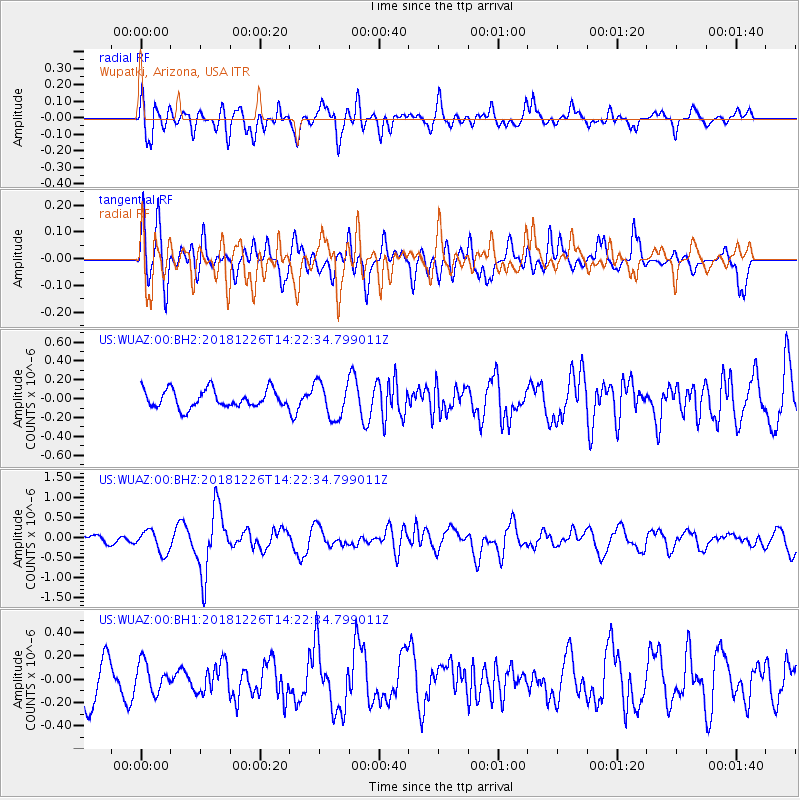
WUAZ Wupatki, Arizona, USA - Earthquake Result Viewer
*The percent match for this event was below the threshold and hence no stack was calculated.
| Earthquake location: |
Tonga Islands |
| Earthquake latitude/longitude: |
-17.2/-173.6 |
| Earthquake time(UTC): |
2018/12/26 (360) 14:11:21 GMT |
| Earthquake Depth: |
163 km |
| Earthquake Magnitude: |
6.0 Mi |
| Earthquake Catalog/Contributor: |
NEIC PDE/pt |
|
| Network: |
US United States National Seismic Network |
| Station: |
WUAZ Wupatki, Arizona, USA |
| Lat/Lon: |
35.52 N/111.37 W |
| Elevation: |
1592 m |
|
| Distance: |
78.8 deg |
| Az: |
47.371 deg |
| Baz: |
239.571 deg |
| Ray Param: |
$rayparam |
*The percent match for this event was below the threshold and hence was not used in the summary stack. |
|
| Radial Match: |
63.44085 % |
| Radial Bump: |
400 |
| Transverse Match: |
52.24568 % |
| Transverse Bump: |
400 |
| SOD ConfigId: |
3201911 |
| Insert Time: |
2019-01-09 14:22:01.042 +0000 |
| GWidth: |
2.5 |
| Max Bumps: |
400 |
| Tol: |
0.001 |
|
Signal To Noise
| Channel | StoN | STA | LTA |
| US:WUAZ:00:BHZ:20181226T14:22:34.799011Z | 2.5178068 | 2.7751406E-7 | 1.10220554E-7 |
| US:WUAZ:00:BH1:20181226T14:22:34.799011Z | 0.7952417 | 1.2572582E-7 | 1.580976E-7 |
| US:WUAZ:00:BH2:20181226T14:22:34.799011Z | 1.9731591 | 1.8855762E-7 | 9.556129E-8 |
| Arrivals |
| Ps | |
| PpPs | |
| PsPs/PpSs | |


