You are here: Home > Network List > UU - University of Utah Regional Network Stations List
> Station KNB Kanab, UT, USA > Earthquake Result Viewer
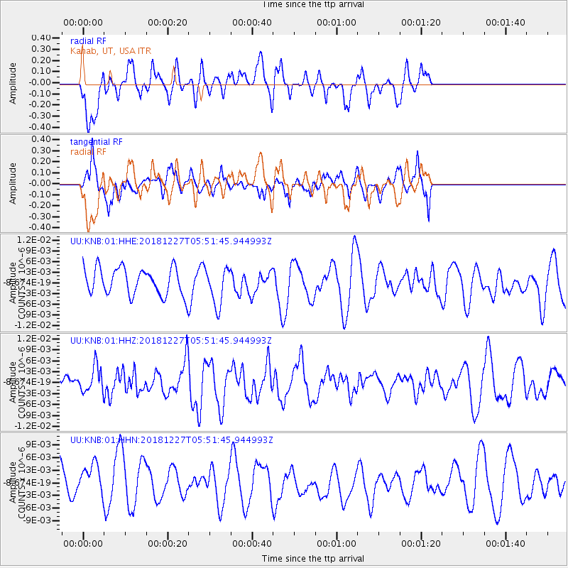
KNB Kanab, UT, USA - Earthquake Result Viewer
*The percent match for this event was below the threshold and hence no stack was calculated.
| Earthquake location: |
Solomon Islands |
| Earthquake latitude/longitude: |
-10.1/161.1 |
| Earthquake time(UTC): |
2018/12/27 (361) 05:39:12 GMT |
| Earthquake Depth: |
71 km |
| Earthquake Magnitude: |
5.4 Mww |
| Earthquake Catalog/Contributor: |
NEIC PDE/us |
|
| Network: |
UU University of Utah Regional Network |
| Station: |
KNB Kanab, UT, USA |
| Lat/Lon: |
37.02 N/112.82 W |
| Elevation: |
1715 m |
|
| Distance: |
92.8 deg |
| Az: |
53.079 deg |
| Baz: |
259.619 deg |
| Ray Param: |
$rayparam |
*The percent match for this event was below the threshold and hence was not used in the summary stack. |
|
| Radial Match: |
61.77302 % |
| Radial Bump: |
400 |
| Transverse Match: |
58.13644 % |
| Transverse Bump: |
400 |
| SOD ConfigId: |
3201911 |
| Insert Time: |
2019-01-10 05:56:29.903 +0000 |
| GWidth: |
2.5 |
| Max Bumps: |
400 |
| Tol: |
0.001 |
|
Signal To Noise
| Channel | StoN | STA | LTA |
| UU:KNB:01:HHZ:20181227T05:51:45.944993Z | 1.0908359 | 3.669386E-9 | 3.3638292E-9 |
| UU:KNB:01:HHN:20181227T05:51:45.944993Z | 1.2565197 | 4.942393E-9 | 3.933399E-9 |
| UU:KNB:01:HHE:20181227T05:51:45.944993Z | 1.426649 | 5.355188E-9 | 3.753683E-9 |
| Arrivals |
| Ps | |
| PpPs | |
| PsPs/PpSs | |


