You are here: Home > Network List > TA - USArray Transportable Network (new EarthScope stations) Stations List
> Station X35A Drake, OK, USA > Earthquake Result Viewer
X35A Drake, OK, USA - Earthquake Result Viewer

| Earthquake location: |
Andreanof Islands, Aleutian Is. |
| Earthquake latitude/longitude: |
51.8/-176.1 |
| Earthquake time(UTC): |
2010/07/14 (195) 11:01:27 GMT |
| Earthquake Depth: |
51 km |
| Earthquake Magnitude: |
5.6 MB, 5.6 MW, 4.9 ML |
| Earthquake Catalog/Contributor: |
WHDF/NEIC |
|
| Network: |
TA USArray Transportable Network (new EarthScope stations) |
| Station: |
X35A Drake, OK, USA |
| Lat/Lon: |
34.40 N/96.97 W |
| Elevation: |
300 m |
|
| Distance: |
57.5 deg |
| Az: |
74.383 deg |
| Baz: |
313.691 deg |
| Ray Param: |
0.06334838 |
| Estimated Moho Depth: |
18.75 km |
| Estimated Crust Vp/Vs: |
2.03 |
| Assumed Crust Vp: |
6.426 km/s |
| Estimated Crust Vs: |
3.169 km/s |
| Estimated Crust Poisson's Ratio: |
0.34 |
|
| Radial Match: |
82.368256 % |
| Radial Bump: |
400 |
| Transverse Match: |
57.09055 % |
| Transverse Bump: |
400 |
| SOD ConfigId: |
319893 |
| Insert Time: |
2011-01-05 04:00:07.391 +0000 |
| GWidth: |
2.5 |
| Max Bumps: |
400 |
| Tol: |
0.001 |
|
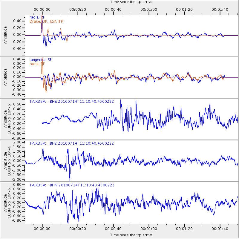
Signal To Noise
| Channel | StoN | STA | LTA |
| TA:X35A: :BHZ:20100714T11:10:40.450022Z | 2.2376359 | 5.461086E-7 | 2.4405605E-7 |
| TA:X35A: :BHN:20100714T11:10:40.450022Z | 1.1836274 | 2.3151648E-7 | 1.9559913E-7 |
| TA:X35A: :BHE:20100714T11:10:40.450022Z | 2.0268764 | 1.945553E-7 | 9.5987744E-8 |
| Arrivals |
| Ps | 3.1 SECOND |
| PpPs | 8.5 SECOND |
| PsPs/PpSs | 12 SECOND |


