You are here: Home > Network List > TA - USArray Transportable Network (new EarthScope stations) Stations List
> Station O33A Hebron, NE, USA > Earthquake Result Viewer
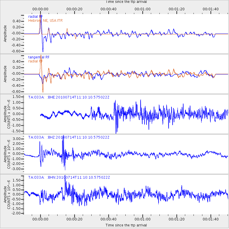
O33A Hebron, NE, USA - Earthquake Result Viewer
*The percent match for this event was below the threshold and hence no stack was calculated.
| Earthquake location: |
Andreanof Islands, Aleutian Is. |
| Earthquake latitude/longitude: |
51.8/-176.1 |
| Earthquake time(UTC): |
2010/07/14 (195) 11:01:27 GMT |
| Earthquake Depth: |
51 km |
| Earthquake Magnitude: |
5.6 MB, 5.6 MW, 4.9 ML |
| Earthquake Catalog/Contributor: |
WHDF/NEIC |
|
| Network: |
TA USArray Transportable Network (new EarthScope stations) |
| Station: |
O33A Hebron, NE, USA |
| Lat/Lon: |
40.08 N/97.58 W |
| Elevation: |
480 m |
|
| Distance: |
53.3 deg |
| Az: |
69.68 deg |
| Baz: |
310.648 deg |
| Ray Param: |
$rayparam |
*The percent match for this event was below the threshold and hence was not used in the summary stack. |
|
| Radial Match: |
76.91328 % |
| Radial Bump: |
400 |
| Transverse Match: |
77.45387 % |
| Transverse Bump: |
400 |
| SOD ConfigId: |
319893 |
| Insert Time: |
2011-01-05 04:01:25.618 +0000 |
| GWidth: |
2.5 |
| Max Bumps: |
400 |
| Tol: |
0.001 |
|
Signal To Noise
| Channel | StoN | STA | LTA |
| TA:O33A: :BHZ:20100714T11:10:10.575022Z | 3.528704 | 9.2214975E-7 | 2.6132815E-7 |
| TA:O33A: :BHN:20100714T11:10:10.575022Z | 2.8560436 | 4.4161354E-7 | 1.5462423E-7 |
| TA:O33A: :BHE:20100714T11:10:10.575022Z | 1.7168139 | 3.070386E-7 | 1.788421E-7 |
| Arrivals |
| Ps | |
| PpPs | |
| PsPs/PpSs | |


