You are here: Home > Network List > US - United States National Seismic Network Stations List
> Station EGMT Eagleton, Montana, USA > Earthquake Result Viewer
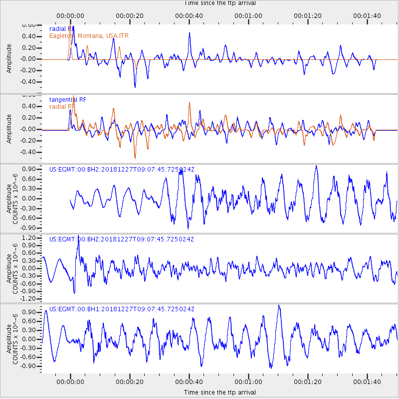
EGMT Eagleton, Montana, USA - Earthquake Result Viewer
*The percent match for this event was below the threshold and hence no stack was calculated.
| Earthquake location: |
Near Coast Of Venezuela |
| Earthquake latitude/longitude: |
10.3/-67.9 |
| Earthquake time(UTC): |
2018/12/27 (361) 08:59:11 GMT |
| Earthquake Depth: |
10 km |
| Earthquake Magnitude: |
5.6 Mww |
| Earthquake Catalog/Contributor: |
NEIC PDE/us |
|
| Network: |
US United States National Seismic Network |
| Station: |
EGMT Eagleton, Montana, USA |
| Lat/Lon: |
48.02 N/109.75 W |
| Elevation: |
1055 m |
|
| Distance: |
51.4 deg |
| Az: |
325.052 deg |
| Baz: |
122.882 deg |
| Ray Param: |
$rayparam |
*The percent match for this event was below the threshold and hence was not used in the summary stack. |
|
| Radial Match: |
73.13308 % |
| Radial Bump: |
400 |
| Transverse Match: |
59.11359 % |
| Transverse Bump: |
362 |
| SOD ConfigId: |
3201911 |
| Insert Time: |
2019-01-10 09:18:27.364 +0000 |
| GWidth: |
2.5 |
| Max Bumps: |
400 |
| Tol: |
0.001 |
|
Signal To Noise
| Channel | StoN | STA | LTA |
| US:EGMT:00:BHZ:20181227T09:07:45.725024Z | 2.636274 | 5.462033E-7 | 2.0718758E-7 |
| US:EGMT:00:BH1:20181227T09:07:45.725024Z | 0.37074035 | 1.3712763E-7 | 3.6987512E-7 |
| US:EGMT:00:BH2:20181227T09:07:45.725024Z | 1.7203479 | 3.8613427E-7 | 2.2445127E-7 |
| Arrivals |
| Ps | |
| PpPs | |
| PsPs/PpSs | |


