You are here: Home > Network List > US - United States National Seismic Network Stations List
> Station DGMT Dagmar, Montana, USA > Earthquake Result Viewer
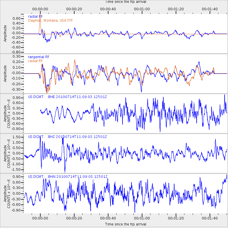
DGMT Dagmar, Montana, USA - Earthquake Result Viewer
*The percent match for this event was below the threshold and hence no stack was calculated.
| Earthquake location: |
Andreanof Islands, Aleutian Is. |
| Earthquake latitude/longitude: |
51.8/-176.1 |
| Earthquake time(UTC): |
2010/07/14 (195) 11:01:27 GMT |
| Earthquake Depth: |
51 km |
| Earthquake Magnitude: |
5.6 MB, 5.6 MW, 4.9 ML |
| Earthquake Catalog/Contributor: |
WHDF/NEIC |
|
| Network: |
US United States National Seismic Network |
| Station: |
DGMT Dagmar, Montana, USA |
| Lat/Lon: |
48.47 N/104.20 W |
| Elevation: |
0.0 m |
|
| Distance: |
44.5 deg |
| Az: |
64.523 deg |
| Baz: |
302.633 deg |
| Ray Param: |
$rayparam |
*The percent match for this event was below the threshold and hence was not used in the summary stack. |
|
| Radial Match: |
74.61423 % |
| Radial Bump: |
400 |
| Transverse Match: |
53.952347 % |
| Transverse Bump: |
400 |
| SOD ConfigId: |
319893 |
| Insert Time: |
2011-01-05 04:04:14.865 +0000 |
| GWidth: |
2.5 |
| Max Bumps: |
400 |
| Tol: |
0.001 |
|
Signal To Noise
| Channel | StoN | STA | LTA |
| US:DGMT: :BHZ:20100714T11:09:03.12501Z | 4.510113 | 6.53829E-7 | 1.4496953E-7 |
| US:DGMT: :BHN:20100714T11:09:03.12501Z | 1.3502747 | 4.2027222E-7 | 3.1124944E-7 |
| US:DGMT: :BHE:20100714T11:09:03.12501Z | 1.2646978 | 3.0358683E-7 | 2.4004694E-7 |
| Arrivals |
| Ps | |
| PpPs | |
| PsPs/PpSs | |


