You are here: Home > Network List > IW - Intermountain West Stations List
> Station PLID Pearl Lake, Idaho, USA > Earthquake Result Viewer
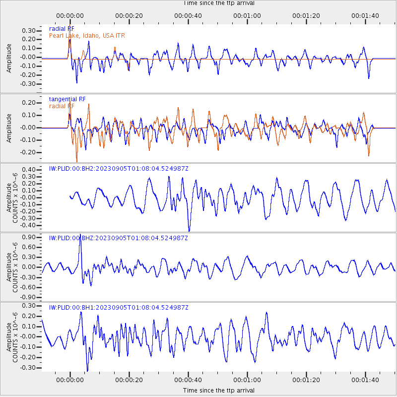
PLID Pearl Lake, Idaho, USA - Earthquake Result Viewer
*The percent match for this event was below the threshold and hence no stack was calculated.
| Earthquake location: |
South Of Fiji Islands |
| Earthquake latitude/longitude: |
-23.9/175.5 |
| Earthquake time(UTC): |
2023/09/05 (248) 00:55:24 GMT |
| Earthquake Depth: |
12 km |
| Earthquake Magnitude: |
5.7 Mww |
| Earthquake Catalog/Contributor: |
NEIC PDE/us |
|
| Network: |
IW Intermountain West |
| Station: |
PLID Pearl Lake, Idaho, USA |
| Lat/Lon: |
45.09 N/116.00 W |
| Elevation: |
2164 m |
|
| Distance: |
92.7 deg |
| Az: |
41.298 deg |
| Baz: |
238.475 deg |
| Ray Param: |
$rayparam |
*The percent match for this event was below the threshold and hence was not used in the summary stack. |
|
| Radial Match: |
51.0422 % |
| Radial Bump: |
339 |
| Transverse Match: |
47.17412 % |
| Transverse Bump: |
400 |
| SOD ConfigId: |
31937991 |
| Insert Time: |
2023-09-19 01:12:00.250 +0000 |
| GWidth: |
2.5 |
| Max Bumps: |
400 |
| Tol: |
0.001 |
|
Signal To Noise
| Channel | StoN | STA | LTA |
| IW:PLID:00:BHZ:20230905T01:08:04.524987Z | 3.4682837 | 3.4521162E-7 | 9.953385E-8 |
| IW:PLID:00:BH1:20230905T01:08:04.524987Z | 0.94633144 | 9.6899264E-8 | 1.0239464E-7 |
| IW:PLID:00:BH2:20230905T01:08:04.524987Z | 1.4835198 | 1.4295514E-7 | 9.6362136E-8 |
| Arrivals |
| Ps | |
| PpPs | |
| PsPs/PpSs | |


