You are here: Home > Network List > US - United States National Seismic Network Stations List
> Station HAWA Hanford, Washington, USA > Earthquake Result Viewer
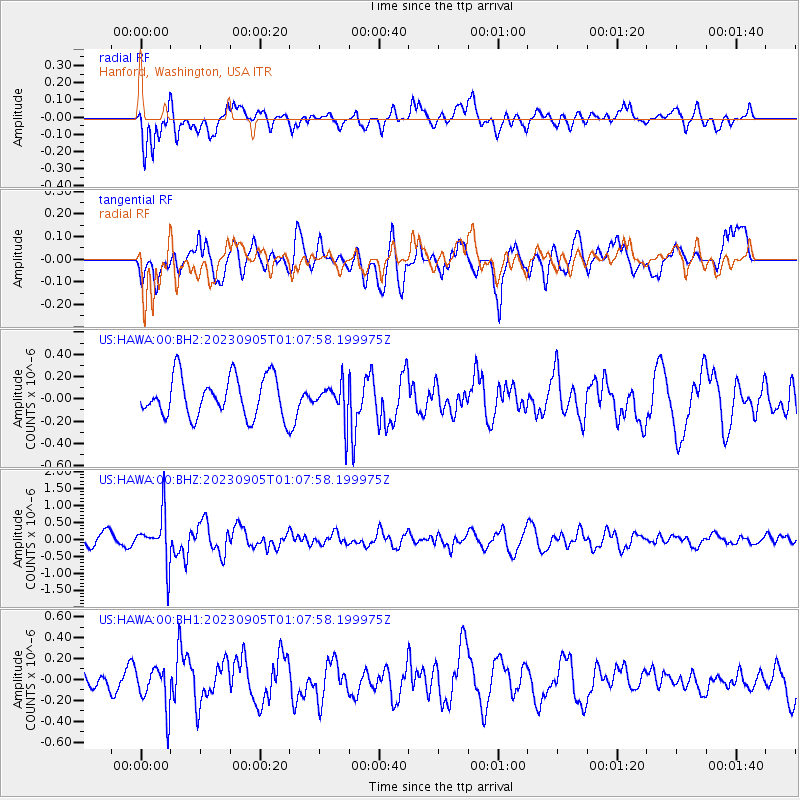
HAWA Hanford, Washington, USA - Earthquake Result Viewer
*The percent match for this event was below the threshold and hence no stack was calculated.
| Earthquake location: |
South Of Fiji Islands |
| Earthquake latitude/longitude: |
-23.9/175.5 |
| Earthquake time(UTC): |
2023/09/05 (248) 00:55:24 GMT |
| Earthquake Depth: |
12 km |
| Earthquake Magnitude: |
5.7 Mww |
| Earthquake Catalog/Contributor: |
NEIC PDE/us |
|
| Network: |
US United States National Seismic Network |
| Station: |
HAWA Hanford, Washington, USA |
| Lat/Lon: |
46.39 N/119.53 W |
| Elevation: |
364 m |
|
| Distance: |
91.4 deg |
| Az: |
38.862 deg |
| Baz: |
236.04 deg |
| Ray Param: |
$rayparam |
*The percent match for this event was below the threshold and hence was not used in the summary stack. |
|
| Radial Match: |
59.03704 % |
| Radial Bump: |
400 |
| Transverse Match: |
56.43916 % |
| Transverse Bump: |
400 |
| SOD ConfigId: |
31937991 |
| Insert Time: |
2023-09-19 01:18:36.590 +0000 |
| GWidth: |
2.5 |
| Max Bumps: |
400 |
| Tol: |
0.001 |
|
Signal To Noise
| Channel | StoN | STA | LTA |
| US:HAWA:00:BHZ:20230905T01:07:58.199975Z | 3.3169334 | 7.169668E-7 | 2.1615351E-7 |
| US:HAWA:00:BH1:20230905T01:07:58.199975Z | 1.4943414 | 2.0162867E-7 | 1.3492811E-7 |
| US:HAWA:00:BH2:20230905T01:07:58.199975Z | 0.9445549 | 1.6823651E-7 | 1.7811195E-7 |
| Arrivals |
| Ps | |
| PpPs | |
| PsPs/PpSs | |


