You are here: Home > Network List > CN - Canadian National Seismograph Network Stations List
> Station INK INUVIK, NT > Earthquake Result Viewer
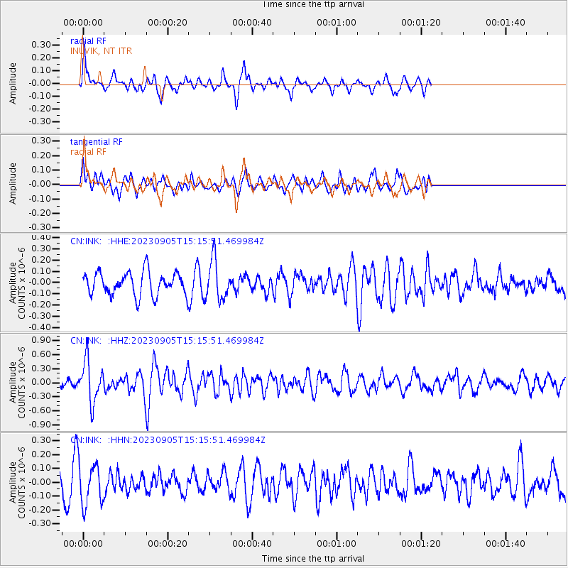
INK INUVIK, NT - Earthquake Result Viewer
*The percent match for this event was below the threshold and hence no stack was calculated.
| Earthquake location: |
New Guinea, Papua New Guinea |
| Earthquake latitude/longitude: |
-5.3/142.9 |
| Earthquake time(UTC): |
2023/09/05 (248) 15:03:17 GMT |
| Earthquake Depth: |
52 km |
| Earthquake Magnitude: |
5.8 mww |
| Earthquake Catalog/Contributor: |
NEIC PDE/us |
|
| Network: |
CN Canadian National Seismograph Network |
| Station: |
INK INUVIK, NT |
| Lat/Lon: |
68.31 N/133.53 W |
| Elevation: |
44 m |
|
| Distance: |
92.5 deg |
| Az: |
21.705 deg |
| Baz: |
262.107 deg |
| Ray Param: |
$rayparam |
*The percent match for this event was below the threshold and hence was not used in the summary stack. |
|
| Radial Match: |
62.974064 % |
| Radial Bump: |
349 |
| Transverse Match: |
39.352413 % |
| Transverse Bump: |
400 |
| SOD ConfigId: |
31937991 |
| Insert Time: |
2023-09-19 15:16:14.386 +0000 |
| GWidth: |
2.5 |
| Max Bumps: |
400 |
| Tol: |
0.001 |
|
Signal To Noise
| Channel | StoN | STA | LTA |
| CN:INK: :HHZ:20230905T15:15:51.469984Z | 3.5868328 | 4.4871513E-7 | 1.2510066E-7 |
| CN:INK: :HHN:20230905T15:15:51.469984Z | 1.1266431 | 1.4590594E-7 | 1.2950503E-7 |
| CN:INK: :HHE:20230905T15:15:51.469984Z | 1.7420763 | 1.7756577E-7 | 1.0192766E-7 |
| Arrivals |
| Ps | |
| PpPs | |
| PsPs/PpSs | |


