You are here: Home > Network List > GS - US Geological Survey Networks Stations List
> Station OK051 E0350 and S34600 Roads, Ralston, OK > Earthquake Result Viewer
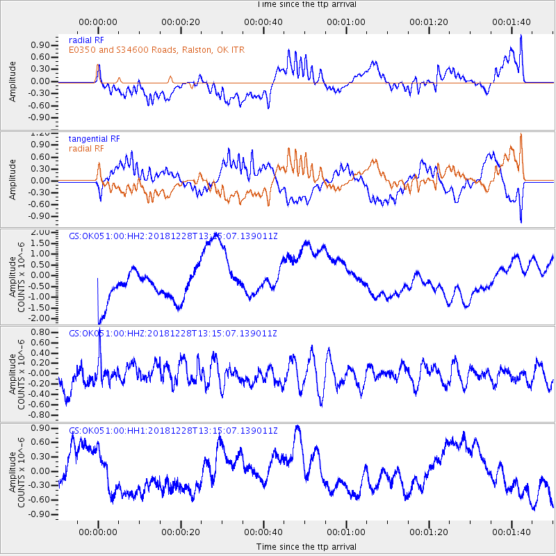
OK051 E0350 and S34600 Roads, Ralston, OK - Earthquake Result Viewer
*The percent match for this event was below the threshold and hence no stack was calculated.
| Earthquake location: |
Kuril Islands |
| Earthquake latitude/longitude: |
44.2/148.6 |
| Earthquake time(UTC): |
2018/12/28 (362) 13:03:33 GMT |
| Earthquake Depth: |
49 km |
| Earthquake Magnitude: |
5.5 mb |
| Earthquake Catalog/Contributor: |
NEIC PDE/us |
|
| Network: |
GS US Geological Survey Networks |
| Station: |
OK051 E0350 and S34600 Roads, Ralston, OK |
| Lat/Lon: |
36.51 N/96.84 W |
| Elevation: |
263 m |
|
| Distance: |
80.2 deg |
| Az: |
48.037 deg |
| Baz: |
318.411 deg |
| Ray Param: |
$rayparam |
*The percent match for this event was below the threshold and hence was not used in the summary stack. |
|
| Radial Match: |
61.32332 % |
| Radial Bump: |
400 |
| Transverse Match: |
50.163982 % |
| Transverse Bump: |
400 |
| SOD ConfigId: |
3201911 |
| Insert Time: |
2019-01-11 13:08:25.965 +0000 |
| GWidth: |
2.5 |
| Max Bumps: |
400 |
| Tol: |
0.001 |
|
Signal To Noise
| Channel | StoN | STA | LTA |
| GS:OK051:00:HHZ:20181228T13:15:07.139011Z | 0.96240044 | 2.4323967E-7 | 2.5274267E-7 |
| GS:OK051:00:HH1:20181228T13:15:07.139011Z | 1.1079336 | 4.1102567E-7 | 3.70984E-7 |
| GS:OK051:00:HH2:20181228T13:15:07.139011Z | 2.011019 | 1.3505271E-6 | 6.7156355E-7 |
| Arrivals |
| Ps | |
| PpPs | |
| PsPs/PpSs | |


