You are here: Home > Network List > TA - USArray Transportable Network (new EarthScope stations) Stations List
> Station S28A Manter, KS, USA > Earthquake Result Viewer
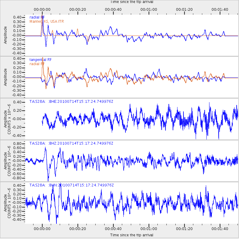
S28A Manter, KS, USA - Earthquake Result Viewer
*The percent match for this event was below the threshold and hence no stack was calculated.
| Earthquake location: |
Near Coast Of Central Chile |
| Earthquake latitude/longitude: |
-38.2/-73.2 |
| Earthquake time(UTC): |
2010/07/14 (195) 15:05:50 GMT |
| Earthquake Depth: |
35 km |
| Earthquake Magnitude: |
5.5 MS, 5.4 MB, 5.8 MW, 5.7 MW |
| Earthquake Catalog/Contributor: |
WHDF/NEIC |
|
| Network: |
TA USArray Transportable Network (new EarthScope stations) |
| Station: |
S28A Manter, KS, USA |
| Lat/Lon: |
37.59 N/101.90 W |
| Elevation: |
1064 m |
|
| Distance: |
79.9 deg |
| Az: |
337.23 deg |
| Baz: |
157.434 deg |
| Ray Param: |
$rayparam |
*The percent match for this event was below the threshold and hence was not used in the summary stack. |
|
| Radial Match: |
67.38813 % |
| Radial Bump: |
400 |
| Transverse Match: |
51.748512 % |
| Transverse Bump: |
378 |
| SOD ConfigId: |
319893 |
| Insert Time: |
2011-01-05 04:23:22.762 +0000 |
| GWidth: |
2.5 |
| Max Bumps: |
400 |
| Tol: |
0.001 |
|
Signal To Noise
| Channel | StoN | STA | LTA |
| TA:S28A: :BHZ:20100714T15:17:24.749976Z | 4.148074 | 3.779142E-7 | 9.1105946E-8 |
| TA:S28A: :BHN:20100714T15:17:24.749976Z | 2.0435262 | 1.7711889E-7 | 8.667316E-8 |
| TA:S28A: :BHE:20100714T15:17:24.749976Z | 1.1138773 | 1.0531375E-7 | 9.4547E-8 |
| Arrivals |
| Ps | |
| PpPs | |
| PsPs/PpSs | |


