You are here: Home > Network List > TA - USArray Transportable Network (new EarthScope stations) Stations List
> Station D30A Buchanan, ND, USA > Earthquake Result Viewer
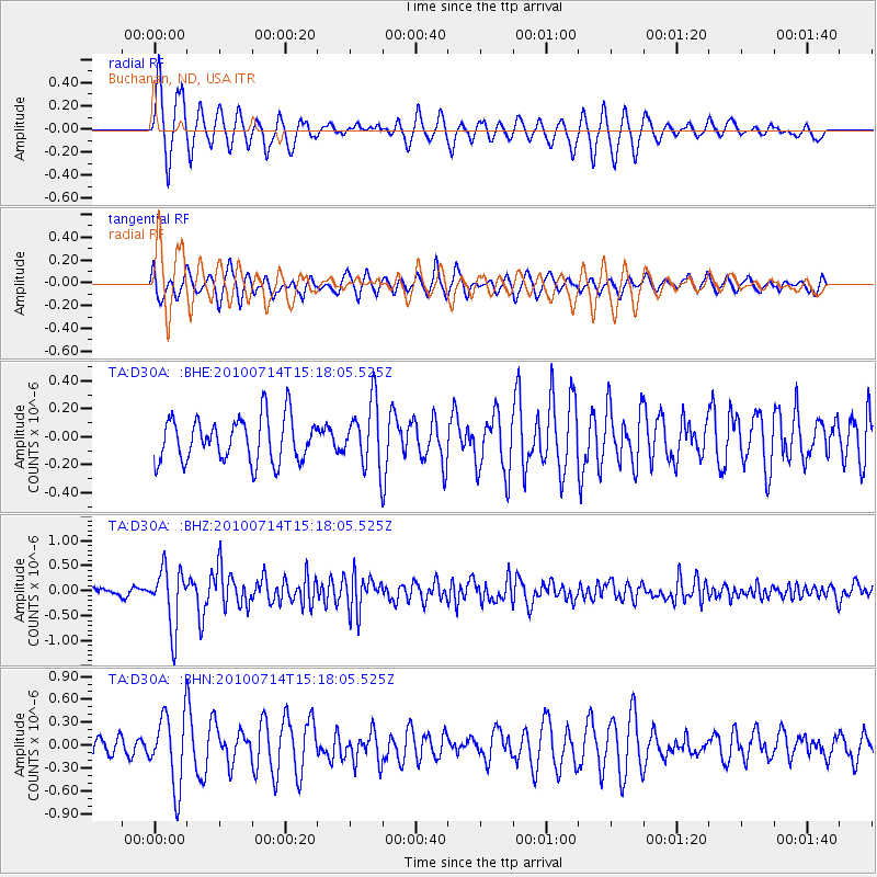
D30A Buchanan, ND, USA - Earthquake Result Viewer
*The percent match for this event was below the threshold and hence no stack was calculated.
| Earthquake location: |
Near Coast Of Central Chile |
| Earthquake latitude/longitude: |
-38.2/-73.2 |
| Earthquake time(UTC): |
2010/07/14 (195) 15:05:50 GMT |
| Earthquake Depth: |
35 km |
| Earthquake Magnitude: |
5.5 MS, 5.4 MB, 5.8 MW, 5.7 MW |
| Earthquake Catalog/Contributor: |
WHDF/NEIC |
|
| Network: |
TA USArray Transportable Network (new EarthScope stations) |
| Station: |
D30A Buchanan, ND, USA |
| Lat/Lon: |
47.11 N/98.76 W |
| Elevation: |
465 m |
|
| Distance: |
88.0 deg |
| Az: |
342.869 deg |
| Baz: |
160.146 deg |
| Ray Param: |
$rayparam |
*The percent match for this event was below the threshold and hence was not used in the summary stack. |
|
| Radial Match: |
72.216385 % |
| Radial Bump: |
400 |
| Transverse Match: |
60.58438 % |
| Transverse Bump: |
400 |
| SOD ConfigId: |
319893 |
| Insert Time: |
2011-01-05 04:28:14.660 +0000 |
| GWidth: |
2.5 |
| Max Bumps: |
400 |
| Tol: |
0.001 |
|
Signal To Noise
| Channel | StoN | STA | LTA |
| TA:D30A: :BHZ:20100714T15:18:05.525Z | 10.116299 | 5.9090564E-7 | 5.841125E-8 |
| TA:D30A: :BHN:20100714T15:18:05.525Z | 2.117455 | 4.7408875E-7 | 2.2389555E-7 |
| TA:D30A: :BHE:20100714T15:18:05.525Z | 1.471805 | 2.3023402E-7 | 1.564297E-7 |
| Arrivals |
| Ps | |
| PpPs | |
| PsPs/PpSs | |


