You are here: Home > Network List > IU - Global Seismograph Network (GSN - IRIS/USGS) Stations List
> Station JOHN Johnston Island, USA > Earthquake Result Viewer
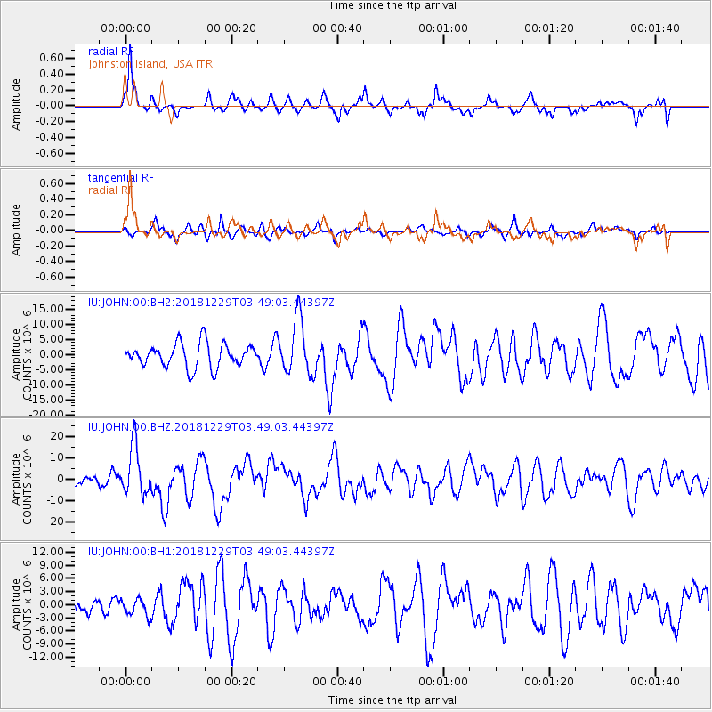
JOHN Johnston Island, USA - Earthquake Result Viewer
*The percent match for this event was below the threshold and hence no stack was calculated.
| Earthquake location: |
Mindanao, Philippines |
| Earthquake latitude/longitude: |
5.8/126.9 |
| Earthquake time(UTC): |
2018/12/29 (363) 03:39:12 GMT |
| Earthquake Depth: |
49 km |
| Earthquake Magnitude: |
7.2 Mi |
| Earthquake Catalog/Contributor: |
NEIC PDE/at |
|
| Network: |
IU Global Seismograph Network (GSN - IRIS/USGS) |
| Station: |
JOHN Johnston Island, USA |
| Lat/Lon: |
16.73 N/169.53 W |
| Elevation: |
2.0 m |
|
| Distance: |
63.1 deg |
| Az: |
74.257 deg |
| Baz: |
268.038 deg |
| Ray Param: |
$rayparam |
*The percent match for this event was below the threshold and hence was not used in the summary stack. |
|
| Radial Match: |
77.12688 % |
| Radial Bump: |
346 |
| Transverse Match: |
52.428596 % |
| Transverse Bump: |
295 |
| SOD ConfigId: |
3201911 |
| Insert Time: |
2019-01-12 03:47:21.374 +0000 |
| GWidth: |
2.5 |
| Max Bumps: |
400 |
| Tol: |
0.001 |
|
Signal To Noise
| Channel | StoN | STA | LTA |
| IU:JOHN:00:BHZ:20181229T03:49:03.44397Z | 2.2739897 | 1.1540162E-5 | 5.074852E-6 |
| IU:JOHN:00:BH1:20181229T03:49:03.44397Z | 0.4291935 | 1.9103697E-6 | 4.451069E-6 |
| IU:JOHN:00:BH2:20181229T03:49:03.44397Z | 2.3343806 | 9.214554E-6 | 3.9473225E-6 |
| Arrivals |
| Ps | |
| PpPs | |
| PsPs/PpSs | |


