You are here: Home > Network List > US - United States National Seismic Network Stations List
> Station WMOK Wichita Mountains, Oklahoma, USA > Earthquake Result Viewer
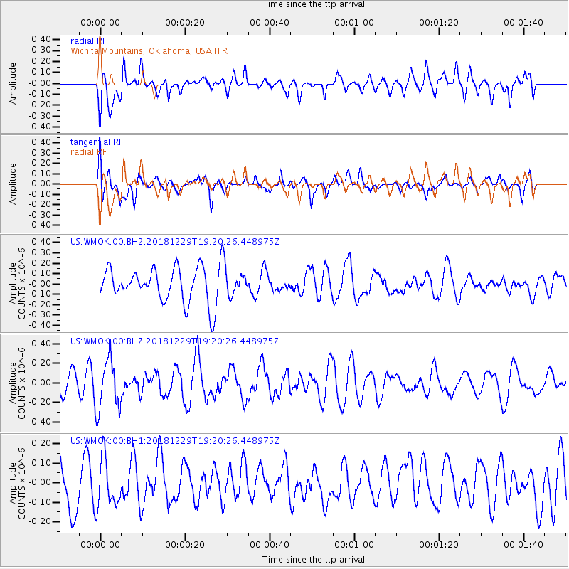
WMOK Wichita Mountains, Oklahoma, USA - Earthquake Result Viewer
*The percent match for this event was below the threshold and hence no stack was calculated.
| Earthquake location: |
Hokkaido, Japan Region |
| Earthquake latitude/longitude: |
42.3/143.2 |
| Earthquake time(UTC): |
2018/12/29 (363) 19:08:30 GMT |
| Earthquake Depth: |
58 km |
| Earthquake Magnitude: |
5.5 mb |
| Earthquake Catalog/Contributor: |
NEIC PDE/us |
|
| Network: |
US United States National Seismic Network |
| Station: |
WMOK Wichita Mountains, Oklahoma, USA |
| Lat/Lon: |
34.74 N/98.78 W |
| Elevation: |
486 m |
|
| Distance: |
84.6 deg |
| Az: |
46.918 deg |
| Baz: |
318.835 deg |
| Ray Param: |
$rayparam |
*The percent match for this event was below the threshold and hence was not used in the summary stack. |
|
| Radial Match: |
38.004032 % |
| Radial Bump: |
400 |
| Transverse Match: |
52.286045 % |
| Transverse Bump: |
400 |
| SOD ConfigId: |
3201911 |
| Insert Time: |
2019-01-12 19:18:31.322 +0000 |
| GWidth: |
2.5 |
| Max Bumps: |
400 |
| Tol: |
0.001 |
|
Signal To Noise
| Channel | StoN | STA | LTA |
| US:WMOK:00:BHZ:20181229T19:20:26.448975Z | 2.751979 | 2.6115404E-7 | 9.489681E-8 |
| US:WMOK:00:BH1:20181229T19:20:26.448975Z | 1.4536998 | 1.2436625E-7 | 8.5551534E-8 |
| US:WMOK:00:BH2:20181229T19:20:26.448975Z | 1.0049826 | 1.3282657E-7 | 1.3216803E-7 |
| Arrivals |
| Ps | |
| PpPs | |
| PsPs/PpSs | |


