You are here: Home > Network List > TA - USArray Transportable Network (new EarthScope stations) Stations List
> Station G21A Lodge Grass, MT, USA > Earthquake Result Viewer
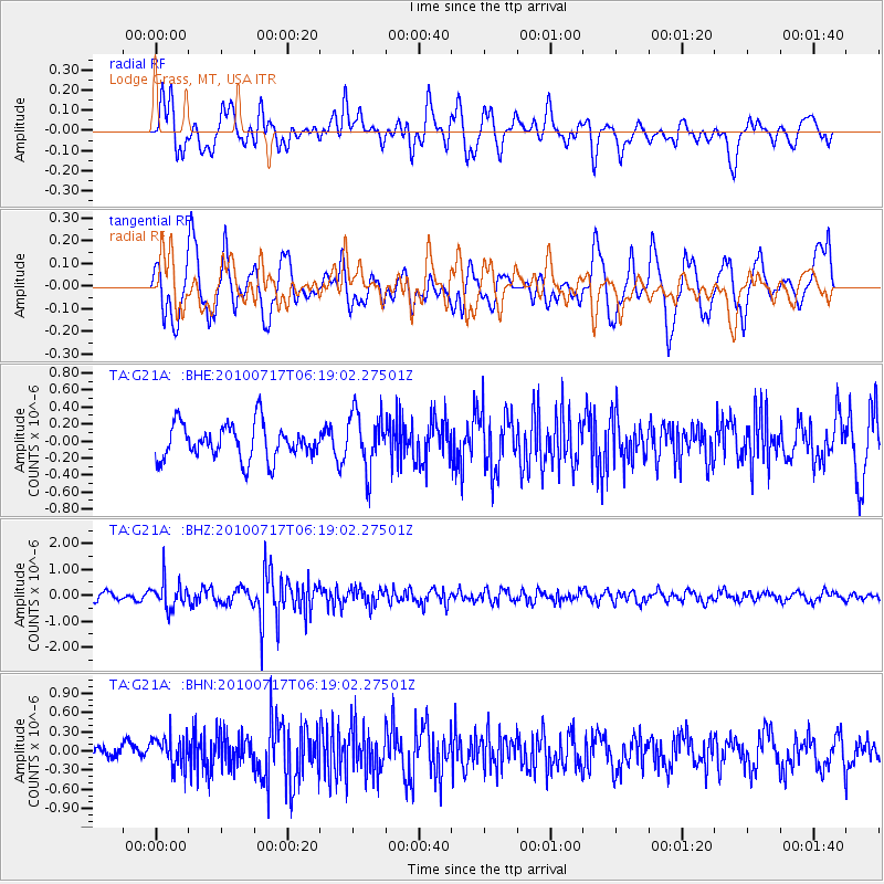
G21A Lodge Grass, MT, USA - Earthquake Result Viewer
*The percent match for this event was below the threshold and hence no stack was calculated.
| Earthquake location: |
Northern Chile |
| Earthquake latitude/longitude: |
-24.7/-69.8 |
| Earthquake time(UTC): |
2010/07/17 (198) 06:07:42 GMT |
| Earthquake Depth: |
49 km |
| Earthquake Magnitude: |
5.7 MB, 5.5 MW, 5.5 MW |
| Earthquake Catalog/Contributor: |
WHDF/NEIC |
|
| Network: |
TA USArray Transportable Network (new EarthScope stations) |
| Station: |
G21A Lodge Grass, MT, USA |
| Lat/Lon: |
45.22 N/107.21 W |
| Elevation: |
1227 m |
|
| Distance: |
77.5 deg |
| Az: |
333.938 deg |
| Baz: |
145.572 deg |
| Ray Param: |
$rayparam |
*The percent match for this event was below the threshold and hence was not used in the summary stack. |
|
| Radial Match: |
69.05052 % |
| Radial Bump: |
400 |
| Transverse Match: |
65.18707 % |
| Transverse Bump: |
400 |
| SOD ConfigId: |
319893 |
| Insert Time: |
2011-01-05 04:50:17.255 +0000 |
| GWidth: |
2.5 |
| Max Bumps: |
400 |
| Tol: |
0.001 |
|
Signal To Noise
| Channel | StoN | STA | LTA |
| TA:G21A: :BHZ:20100717T06:19:02.27501Z | 3.1036022 | 5.1978003E-7 | 1.6747639E-7 |
| TA:G21A: :BHN:20100717T06:19:02.27501Z | 1.30778 | 2.4814608E-7 | 1.8974603E-7 |
| TA:G21A: :BHE:20100717T06:19:02.27501Z | 1.6027515 | 3.2888576E-7 | 2.052007E-7 |
| Arrivals |
| Ps | |
| PpPs | |
| PsPs/PpSs | |


