You are here: Home > Network List > TA - USArray Transportable Network (new EarthScope stations) Stations List
> Station I19A Meeteetse, WY, USA > Earthquake Result Viewer
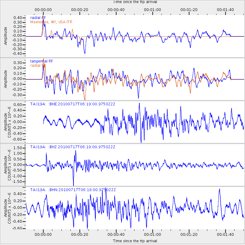
I19A Meeteetse, WY, USA - Earthquake Result Viewer
*The percent match for this event was below the threshold and hence no stack was calculated.
| Earthquake location: |
Northern Chile |
| Earthquake latitude/longitude: |
-24.7/-69.8 |
| Earthquake time(UTC): |
2010/07/17 (198) 06:07:42 GMT |
| Earthquake Depth: |
49 km |
| Earthquake Magnitude: |
5.7 MB, 5.5 MW, 5.5 MW |
| Earthquake Catalog/Contributor: |
WHDF/NEIC |
|
| Network: |
TA USArray Transportable Network (new EarthScope stations) |
| Station: |
I19A Meeteetse, WY, USA |
| Lat/Lon: |
44.04 N/108.99 W |
| Elevation: |
1982 m |
|
| Distance: |
77.3 deg |
| Az: |
332.167 deg |
| Baz: |
143.934 deg |
| Ray Param: |
$rayparam |
*The percent match for this event was below the threshold and hence was not used in the summary stack. |
|
| Radial Match: |
61.602985 % |
| Radial Bump: |
400 |
| Transverse Match: |
51.515476 % |
| Transverse Bump: |
400 |
| SOD ConfigId: |
319893 |
| Insert Time: |
2011-01-05 04:51:29.584 +0000 |
| GWidth: |
2.5 |
| Max Bumps: |
400 |
| Tol: |
0.001 |
|
Signal To Noise
| Channel | StoN | STA | LTA |
| TA:I19A: :BHZ:20100717T06:19:00.975022Z | 4.2108226 | 3.2437893E-7 | 7.703458E-8 |
| TA:I19A: :BHN:20100717T06:19:00.975022Z | 1.5912249 | 1.8842145E-7 | 1.1841283E-7 |
| TA:I19A: :BHE:20100717T06:19:00.975022Z | 1.5632403 | 1.5628906E-7 | 9.9977626E-8 |
| Arrivals |
| Ps | |
| PpPs | |
| PsPs/PpSs | |


