You are here: Home > Network List > TA - USArray Transportable Network (new EarthScope stations) Stations List
> Station Q26A Hugo, CO, USA > Earthquake Result Viewer
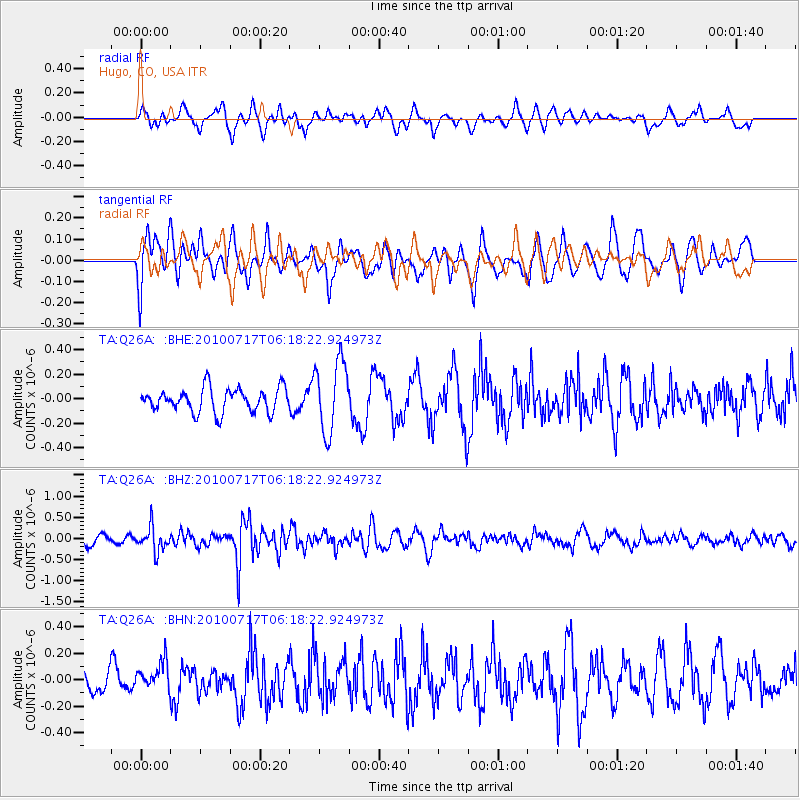
Q26A Hugo, CO, USA - Earthquake Result Viewer
*The percent match for this event was below the threshold and hence no stack was calculated.
| Earthquake location: |
Northern Chile |
| Earthquake latitude/longitude: |
-24.7/-69.8 |
| Earthquake time(UTC): |
2010/07/17 (198) 06:07:42 GMT |
| Earthquake Depth: |
49 km |
| Earthquake Magnitude: |
5.7 MB, 5.5 MW, 5.5 MW |
| Earthquake Catalog/Contributor: |
WHDF/NEIC |
|
| Network: |
TA USArray Transportable Network (new EarthScope stations) |
| Station: |
Q26A Hugo, CO, USA |
| Lat/Lon: |
38.92 N/103.52 W |
| Elevation: |
1546 m |
|
| Distance: |
70.7 deg |
| Az: |
332.725 deg |
| Baz: |
147.705 deg |
| Ray Param: |
$rayparam |
*The percent match for this event was below the threshold and hence was not used in the summary stack. |
|
| Radial Match: |
47.29303 % |
| Radial Bump: |
400 |
| Transverse Match: |
59.509865 % |
| Transverse Bump: |
400 |
| SOD ConfigId: |
319893 |
| Insert Time: |
2011-01-05 04:54:31.596 +0000 |
| GWidth: |
2.5 |
| Max Bumps: |
400 |
| Tol: |
0.001 |
|
Signal To Noise
| Channel | StoN | STA | LTA |
| TA:Q26A: :BHZ:20100717T06:18:22.924973Z | 3.472759 | 2.835158E-7 | 8.1639925E-8 |
| TA:Q26A: :BHN:20100717T06:18:22.924973Z | 1.1319962 | 1.1295461E-7 | 9.978356E-8 |
| TA:Q26A: :BHE:20100717T06:18:22.924973Z | 3.0430093 | 2.93658E-7 | 9.6502504E-8 |
| Arrivals |
| Ps | |
| PpPs | |
| PsPs/PpSs | |


