You are here: Home > Network List > GS - US Geological Survey Networks Stations List
> Station OK051 E0350 and S34600 Roads, Ralston, OK > Earthquake Result Viewer
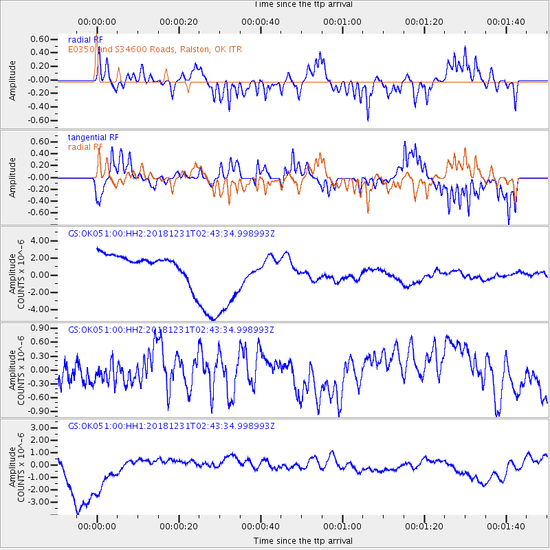
OK051 E0350 and S34600 Roads, Ralston, OK - Earthquake Result Viewer
*The percent match for this event was below the threshold and hence no stack was calculated.
| Earthquake location: |
Alaska Peninsula |
| Earthquake latitude/longitude: |
54.3/-161.4 |
| Earthquake time(UTC): |
2018/12/31 (365) 02:35:38 GMT |
| Earthquake Depth: |
34 km |
| Earthquake Magnitude: |
5.8 Mi |
| Earthquake Catalog/Contributor: |
NEIC PDE/at |
|
| Network: |
GS US Geological Survey Networks |
| Station: |
OK051 E0350 and S34600 Roads, Ralston, OK |
| Lat/Lon: |
36.51 N/96.84 W |
| Elevation: |
263 m |
|
| Distance: |
47.0 deg |
| Az: |
84.705 deg |
| Baz: |
313.529 deg |
| Ray Param: |
$rayparam |
*The percent match for this event was below the threshold and hence was not used in the summary stack. |
|
| Radial Match: |
62.109993 % |
| Radial Bump: |
323 |
| Transverse Match: |
38.493652 % |
| Transverse Bump: |
224 |
| SOD ConfigId: |
3201911 |
| Insert Time: |
2019-01-14 02:48:43.366 +0000 |
| GWidth: |
2.5 |
| Max Bumps: |
400 |
| Tol: |
0.001 |
|
Signal To Noise
| Channel | StoN | STA | LTA |
| GS:OK051:00:HHZ:20181231T02:43:34.998993Z | 1.5528247 | 2.2799341E-7 | 1.4682496E-7 |
| GS:OK051:00:HH1:20181231T02:43:34.998993Z | 1.4034151 | 1.9386882E-6 | 1.3814076E-6 |
| GS:OK051:00:HH2:20181231T02:43:34.998993Z | 3.5250921 | 4.9517635E-6 | 1.404719E-6 |
| Arrivals |
| Ps | |
| PpPs | |
| PsPs/PpSs | |


