You are here: Home > Network List > TA - USArray Transportable Network (new EarthScope stations) Stations List
> Station 431A Sonora, TX, USA > Earthquake Result Viewer
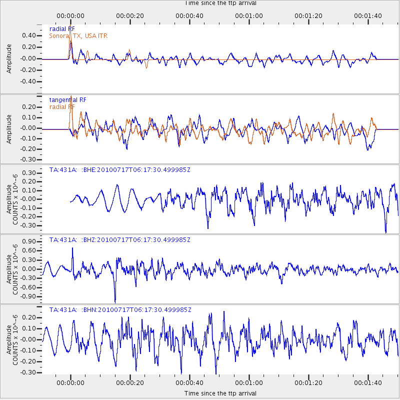
431A Sonora, TX, USA - Earthquake Result Viewer
*The percent match for this event was below the threshold and hence no stack was calculated.
| Earthquake location: |
Northern Chile |
| Earthquake latitude/longitude: |
-24.7/-69.8 |
| Earthquake time(UTC): |
2010/07/17 (198) 06:07:42 GMT |
| Earthquake Depth: |
49 km |
| Earthquake Magnitude: |
5.7 MB, 5.5 MW, 5.5 MW |
| Earthquake Catalog/Contributor: |
WHDF/NEIC |
|
| Network: |
TA USArray Transportable Network (new EarthScope stations) |
| Station: |
431A Sonora, TX, USA |
| Lat/Lon: |
30.68 N/100.61 W |
| Elevation: |
700 m |
|
| Distance: |
62.5 deg |
| Az: |
330.202 deg |
| Baz: |
148.36 deg |
| Ray Param: |
$rayparam |
*The percent match for this event was below the threshold and hence was not used in the summary stack. |
|
| Radial Match: |
60.681038 % |
| Radial Bump: |
400 |
| Transverse Match: |
68.22717 % |
| Transverse Bump: |
400 |
| SOD ConfigId: |
319893 |
| Insert Time: |
2011-01-05 04:56:57.170 +0000 |
| GWidth: |
2.5 |
| Max Bumps: |
400 |
| Tol: |
0.001 |
|
Signal To Noise
| Channel | StoN | STA | LTA |
| TA:431A: :BHZ:20100717T06:17:30.499985Z | 2.0537653 | 2.0597727E-7 | 1.002925E-7 |
| TA:431A: :BHN:20100717T06:17:30.499985Z | 0.984544 | 8.231639E-8 | 8.3608654E-8 |
| TA:431A: :BHE:20100717T06:17:30.499985Z | 0.9391696 | 6.986326E-8 | 7.438834E-8 |
| Arrivals |
| Ps | |
| PpPs | |
| PsPs/PpSs | |


