You are here: Home > Network List > TA - USArray Transportable Network (new EarthScope stations) Stations List
> Station M29A Burnside Ranch, Stapleton, NE, USA > Earthquake Result Viewer
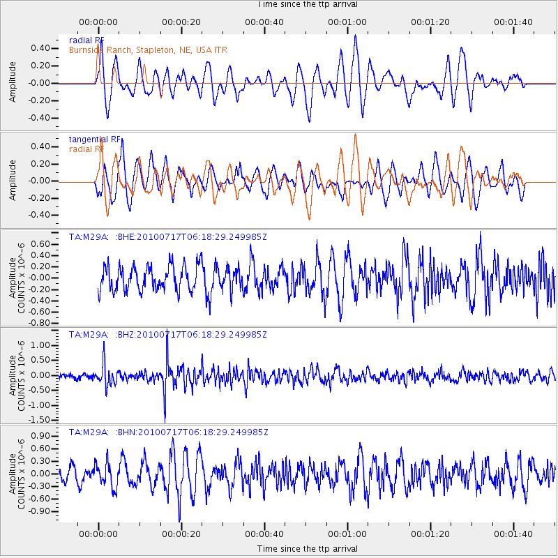
M29A Burnside Ranch, Stapleton, NE, USA - Earthquake Result Viewer
*The percent match for this event was below the threshold and hence no stack was calculated.
| Earthquake location: |
Northern Chile |
| Earthquake latitude/longitude: |
-24.7/-69.8 |
| Earthquake time(UTC): |
2010/07/17 (198) 06:07:42 GMT |
| Earthquake Depth: |
49 km |
| Earthquake Magnitude: |
5.7 MB, 5.5 MW, 5.5 MW |
| Earthquake Catalog/Contributor: |
WHDF/NEIC |
|
| Network: |
TA USArray Transportable Network (new EarthScope stations) |
| Station: |
M29A Burnside Ranch, Stapleton, NE, USA |
| Lat/Lon: |
41.44 N/100.69 W |
| Elevation: |
952 m |
|
| Distance: |
71.8 deg |
| Az: |
336.054 deg |
| Baz: |
150.596 deg |
| Ray Param: |
$rayparam |
*The percent match for this event was below the threshold and hence was not used in the summary stack. |
|
| Radial Match: |
45.10793 % |
| Radial Bump: |
395 |
| Transverse Match: |
57.04783 % |
| Transverse Bump: |
400 |
| SOD ConfigId: |
319893 |
| Insert Time: |
2011-01-05 05:00:12.648 +0000 |
| GWidth: |
2.5 |
| Max Bumps: |
400 |
| Tol: |
0.001 |
|
Signal To Noise
| Channel | StoN | STA | LTA |
| TA:M29A: :BHZ:20100717T06:18:29.249985Z | 4.1438756 | 3.5185695E-7 | 8.491011E-8 |
| TA:M29A: :BHN:20100717T06:18:29.249985Z | 1.1473126 | 2.9242227E-7 | 2.5487583E-7 |
| TA:M29A: :BHE:20100717T06:18:29.249985Z | 0.81096655 | 1.7161516E-7 | 2.1161804E-7 |
| Arrivals |
| Ps | |
| PpPs | |
| PsPs/PpSs | |


