LVA2 AZ.LVA2 - Earthquake Result Viewer
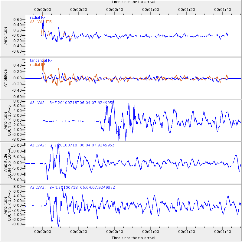
Earthquake location: Fox Islands, Aleutian Islands
Earthquake latitude/longitude: 52.9/-169.8
Earthquake time(UTC): 2010/07/18 (199) 05:56:44 GMT
Earthquake Depth: 14 km
Earthquake Magnitude: 6.3 MB, 6.7 MS, 6.6 MW, 6.6 MW
Earthquake Catalog/Contributor: WHDF/NEIC
Network: AZ ANZA Regional Network
Station: LVA2 AZ.LVA2
Lat/Lon: 33.35 N/116.56 W
Elevation: 1435 m
Distance: 42.4 deg
Az: 95.644 deg
Baz: 313.892 deg
Ray Param: 0.07318963
Estimated Moho Depth: 12.25 km
Estimated Crust Vp/Vs: 1.60
Assumed Crust Vp: 6.264 km/s
Estimated Crust Vs: 3.915 km/s
Estimated Crust Poisson's Ratio: 0.18
Radial Match: 90.4204 %
Radial Bump: 400
Transverse Match: 80.01583 %
Transverse Bump: 400
SOD ConfigId: 319893
Insert Time: 2011-01-05 05:24:31.078 +0000
GWidth: 2.5
Max Bumps: 400
Tol: 0.001

Signal To Noise

ChannelStoNSTALTA
AZ:LVA2: :BHZ:20100718T06:04:07.924995Z34.5733455.847192E-61.6912426E-7
AZ:LVA2: :BHN:20100718T06:04:07.924995Z18.8178272.5062598E-61.331854E-7
AZ:LVA2: :BHE:20100718T06:04:07.924995Z16.5392551.8484375E-61.1176062E-7
Arrivals
Ps1.3 SECOND
PpPs4.7 SECOND
PsPs/PpSs6.0 SECOND