SOL AZ.SOL - Earthquake Result Viewer
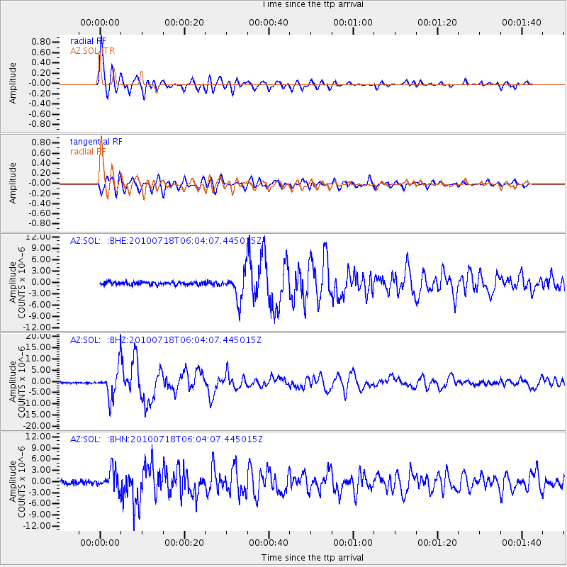
Earthquake location: Fox Islands, Aleutian Islands
Earthquake latitude/longitude: 52.9/-169.8
Earthquake time(UTC): 2010/07/18 (199) 05:56:44 GMT
Earthquake Depth: 14 km
Earthquake Magnitude: 6.3 MB, 6.7 MS, 6.6 MW, 6.6 MW
Earthquake Catalog/Contributor: WHDF/NEIC
Network: AZ ANZA Regional Network
Station: SOL AZ.SOL
Lat/Lon: 32.84 N/117.25 W
Elevation: 245 m
Distance: 42.3 deg
Az: 96.782 deg
Baz: 314.36 deg
Ray Param: 0.07322361
Estimated Moho Depth: 18.25 km
Estimated Crust Vp/Vs: 1.87
Assumed Crust Vp: 6.264 km/s
Estimated Crust Vs: 3.345 km/s
Estimated Crust Poisson's Ratio: 0.30
Radial Match: 95.01541 %
Radial Bump: 400
Transverse Match: 88.60031 %
Transverse Bump: 400
SOD ConfigId: 319893
Insert Time: 2011-01-05 05:24:31.895 +0000
GWidth: 2.5
Max Bumps: 400
Tol: 0.001

Signal To Noise

ChannelStoNSTALTA
AZ:SOL: :BHZ:20100718T06:04:07.445015Z31.89516.823352E-62.1393105E-7
AZ:SOL: :BHN:20100718T06:04:07.445015Z6.74758052.6747493E-63.9640122E-7
AZ:SOL: :BHE:20100718T06:04:07.445015Z9.8954923.6484616E-63.6869938E-7
Arrivals
Ps2.7 SECOND
PpPs7.9 SECOND
PsPs/PpSs11 SECOND