You are here: Home > Network List > US - United States National Seismic Network Stations List
> Station HAWA Hanford, Washington, USA > Earthquake Result Viewer
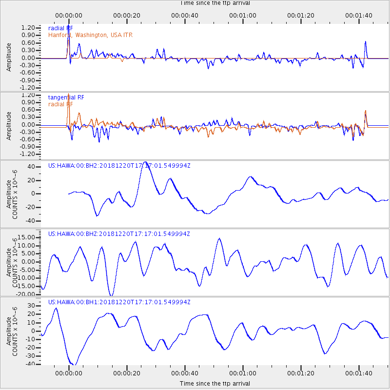
HAWA Hanford, Washington, USA - Earthquake Result Viewer
*The percent match for this event was below the threshold and hence no stack was calculated.
| Earthquake location: |
Komandorskiye Ostrova Region |
| Earthquake latitude/longitude: |
54.9/164.8 |
| Earthquake time(UTC): |
2018/12/20 (354) 17:09:04 GMT |
| Earthquake Depth: |
10 km |
| Earthquake Magnitude: |
5.9 mb |
| Earthquake Catalog/Contributor: |
NEIC PDE/us |
|
| Network: |
US United States National Seismic Network |
| Station: |
HAWA Hanford, Washington, USA |
| Lat/Lon: |
46.39 N/119.53 W |
| Elevation: |
364 m |
|
| Distance: |
46.5 deg |
| Az: |
67.538 deg |
| Baz: |
309.539 deg |
| Ray Param: |
$rayparam |
*The percent match for this event was below the threshold and hence was not used in the summary stack. |
|
| Radial Match: |
26.68401 % |
| Radial Bump: |
400 |
| Transverse Match: |
59.54015 % |
| Transverse Bump: |
316 |
| SOD ConfigId: |
3201911 |
| Insert Time: |
2019-01-15 01:41:08.702 +0000 |
| GWidth: |
2.5 |
| Max Bumps: |
400 |
| Tol: |
0.001 |
|
Signal To Noise
| Channel | StoN | STA | LTA |
| US:HAWA:00:BHZ:20181220T17:17:01.549994Z | 0.76662016 | 5.477233E-6 | 7.1446507E-6 |
| US:HAWA:00:BH1:20181220T17:17:01.549994Z | 2.5804331 | 3.464791E-5 | 1.3427168E-5 |
| US:HAWA:00:BH2:20181220T17:17:01.549994Z | 1.6407542 | 1.835197E-5 | 1.1185081E-5 |
| Arrivals |
| Ps | |
| PpPs | |
| PsPs/PpSs | |


