
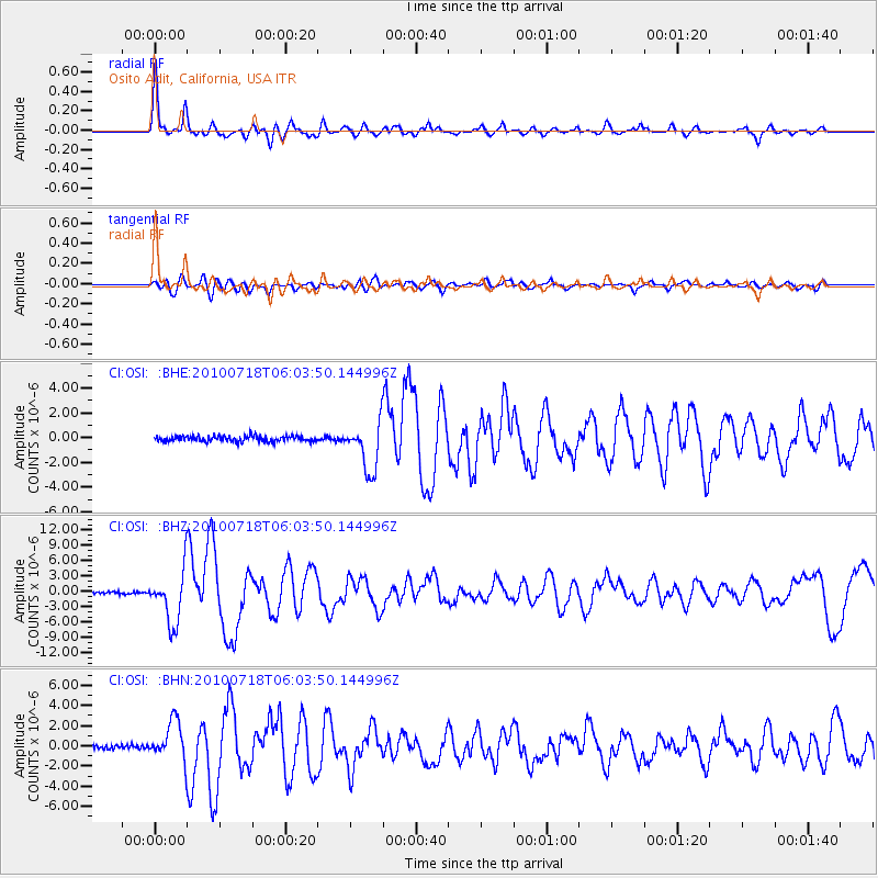
OSI Osito Adit, California, USA - Earthquake Result Viewer
| ||||||||||||||||||
| ||||||||||||||||||
| ||||||||||||||||||
|
Signal To Noise
| Channel | StoN | STA | LTA |
| CI:OSI: :BHZ:20100718T06:03:50.144996Z | 23.509327 | 5.067346E-6 | 2.1554621E-7 |
| CI:OSI: :BHN:20100718T06:03:50.144996Z | 10.441936 | 1.930284E-6 | 1.8485883E-7 |
| CI:OSI: :BHE:20100718T06:03:50.144996Z | 8.753305 | 1.961983E-6 | 2.2414196E-7 |
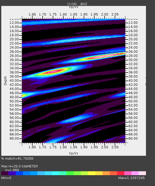
| Arrivals | |
| Ps | 4.8 SECOND |
| PpPs | 13 SECOND |
| PsPs/PpSs | 18 SECOND |

