MPP McPhearson Peak - Earthquake Result Viewer
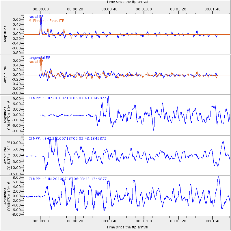
Earthquake location: Fox Islands, Aleutian Islands
Earthquake latitude/longitude: 52.9/-169.8
Earthquake time(UTC): 2010/07/18 (199) 05:56:44 GMT
Earthquake Depth: 14 km
Earthquake Magnitude: 6.3 MB, 6.7 MS, 6.6 MW, 6.6 MW
Earthquake Catalog/Contributor: WHDF/NEIC
Network: CI Caltech Regional Seismic Network
Station: MPP McPhearson Peak
Lat/Lon: 34.89 N/119.81 W
Elevation: 1739 m
Distance: 39.4 deg
Az: 96.776 deg
Baz: 312.932 deg
Ray Param: 0.0750066
Estimated Moho Depth: 13.0 km
Estimated Crust Vp/Vs: 2.09
Assumed Crust Vp: 6.1 km/s
Estimated Crust Vs: 2.919 km/s
Estimated Crust Poisson's Ratio: 0.35
Radial Match: 90.27802 %
Radial Bump: 338
Transverse Match: 78.773575 %
Transverse Bump: 400
SOD ConfigId: 319893
Insert Time: 2011-01-05 05:29:04.258 +0000
GWidth: 2.5
Max Bumps: 400
Tol: 0.001

Signal To Noise

ChannelStoNSTALTA
CI:MPP: :BHZ:20100718T06:03:43.134987Z29.7326874.6765226E-61.5728557E-7
CI:MPP: :BHN:20100718T06:03:43.134987Z12.5092811.8905956E-61.5113544E-7
CI:MPP: :BHE:20100718T06:03:43.134987Z8.3127362.1657304E-62.6053164E-7
Arrivals
Ps2.5 SECOND
PpPs6.2 SECOND
PsPs/PpSs8.7 SECOND