ULM LAC DU BONNET, MB, CANADA - Earthquake Result Viewer
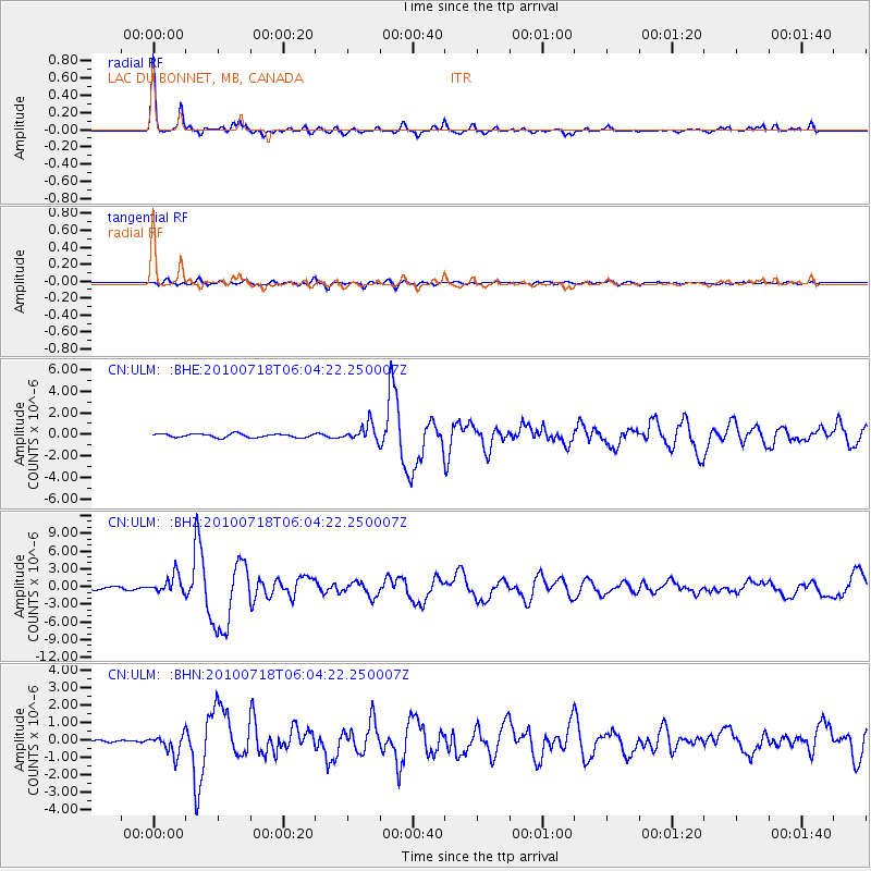
Earthquake location: Fox Islands, Aleutian Islands
Earthquake latitude/longitude: 52.9/-169.8
Earthquake time(UTC): 2010/07/18 (199) 05:56:44 GMT
Earthquake Depth: 14 km
Earthquake Magnitude: 6.3 MB, 6.7 MS, 6.6 MW, 6.6 MW
Earthquake Catalog/Contributor: WHDF/NEIC
Network: CN Canadian National Seismograph Network
Station: ULM LAC DU BONNET, MB, CANADA
Lat/Lon: 50.25 N/95.87 W
Elevation: 251 m
Distance: 44.2 deg
Az: 62.314 deg
Baz: 303.275 deg
Ray Param: 0.07207075
Estimated Moho Depth: 32.25 km
Estimated Crust Vp/Vs: 1.80
Assumed Crust Vp: 6.459 km/s
Estimated Crust Vs: 3.594 km/s
Estimated Crust Poisson's Ratio: 0.28
Radial Match: 95.547676 %
Radial Bump: 290
Transverse Match: 82.282776 %
Transverse Bump: 400
SOD ConfigId: 319893
Insert Time: 2011-01-05 05:30:34.080 +0000
GWidth: 2.5
Max Bumps: 400
Tol: 0.001

Signal To Noise

ChannelStoNSTALTA
CN:ULM: :BHZ:20100718T06:04:22.250007Z6.01878931.5306292E-62.5430847E-7
CN:ULM: :BHN:20100718T06:04:22.250007Z5.20021965.6545093E-71.0873597E-7
CN:ULM: :BHE:20100718T06:04:22.250007Z4.70468337.730521E-71.6431542E-7
Arrivals
Ps4.2 SECOND
PpPs13 SECOND
PsPs/PpSs17 SECOND