UTMT Martin, TN - Earthquake Result Viewer
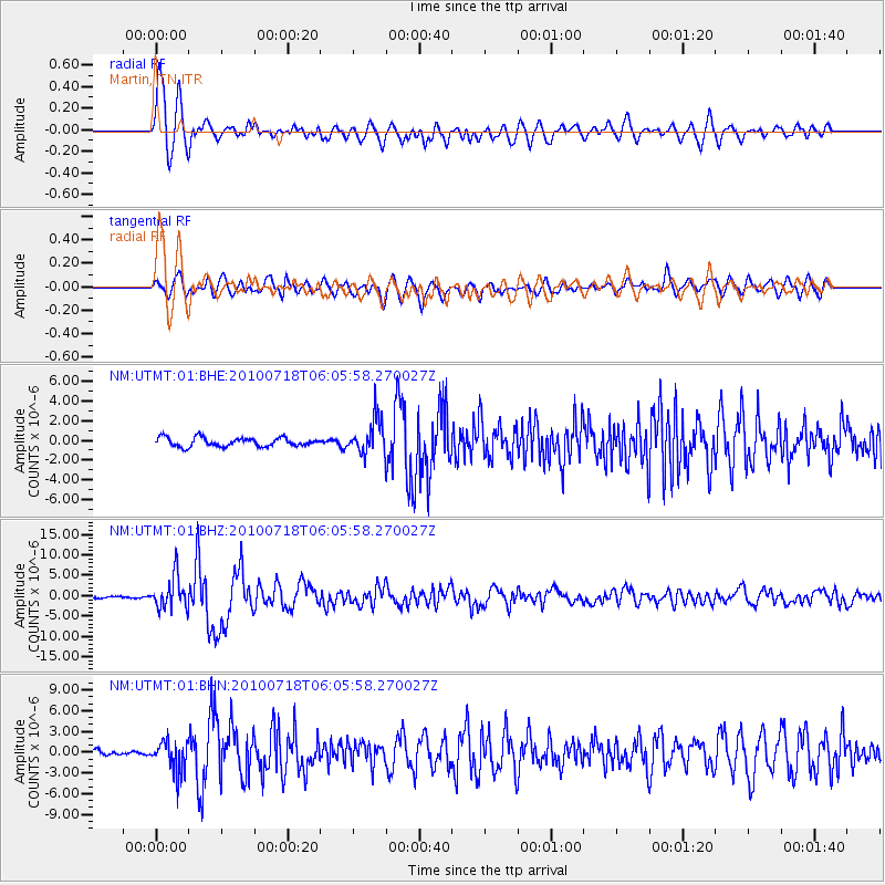
Earthquake location: Fox Islands, Aleutian Islands
Earthquake latitude/longitude: 52.9/-169.8
Earthquake time(UTC): 2010/07/18 (199) 05:56:44 GMT
Earthquake Depth: 14 km
Earthquake Magnitude: 6.3 MB, 6.7 MS, 6.6 MW, 6.6 MW
Earthquake Catalog/Contributor: WHDF/NEIC
Network: NM Cooperative New Madrid Seismic Network
Station: UTMT Martin, TN
Lat/Lon: 36.35 N/88.86 W
Elevation: 110 m
Distance: 56.9 deg
Az: 72.13 deg
Baz: 314.392 deg
Ray Param: 0.06382742
Estimated Moho Depth: 10.0 km
Estimated Crust Vp/Vs: 1.67
Assumed Crust Vp: 6.444 km/s
Estimated Crust Vs: 3.859 km/s
Estimated Crust Poisson's Ratio: 0.22
Radial Match: 90.48636 %
Radial Bump: 400
Transverse Match: 85.363304 %
Transverse Bump: 400
SOD ConfigId: 319893
Insert Time: 2011-01-05 05:39:02.562 +0000
GWidth: 2.5
Max Bumps: 400
Tol: 0.001

Signal To Noise

ChannelStoNSTALTA
NM:UTMT:01:BHZ:20100718T06:05:58.270027Z13.8836093.9895767E-62.8735877E-7
NM:UTMT:01:BHN:20100718T06:05:58.270027Z6.01531122.2143543E-63.6811966E-7
NM:UTMT:01:BHE:20100718T06:05:58.270027Z3.93369961.7400868E-64.4235375E-7
Arrivals
Ps1.1 SECOND
PpPs3.9 SECOND
PsPs/PpSs5.0 SECOND