J22A Midwest, WY, USA - Earthquake Result Viewer
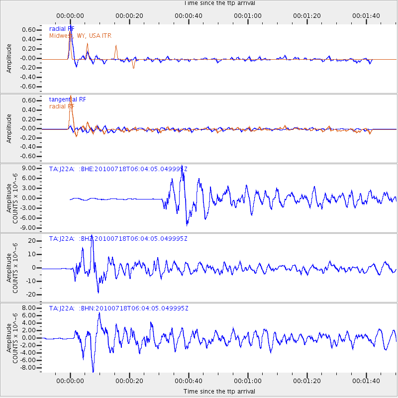
Earthquake location: Fox Islands, Aleutian Islands
Earthquake latitude/longitude: 52.9/-169.8
Earthquake time(UTC): 2010/07/18 (199) 05:56:44 GMT
Earthquake Depth: 14 km
Earthquake Magnitude: 6.3 MB, 6.7 MS, 6.6 MW, 6.6 MW
Earthquake Catalog/Contributor: WHDF/NEIC
Network: TA USArray Transportable Network (new EarthScope stations)
Station: J22A Midwest, WY, USA
Lat/Lon: 43.41 N/106.48 W
Elevation: 1587 m
Distance: 42.0 deg
Az: 76.593 deg
Baz: 305.993 deg
Ray Param: 0.07339693
Estimated Moho Depth: 10.5 km
Estimated Crust Vp/Vs: 1.63
Assumed Crust Vp: 6.178 km/s
Estimated Crust Vs: 3.796 km/s
Estimated Crust Poisson's Ratio: 0.20
Radial Match: 95.94975 %
Radial Bump: 283
Transverse Match: 81.90181 %
Transverse Bump: 400
SOD ConfigId: 319893
Insert Time: 2011-01-05 05:42:47.487 +0000
GWidth: 2.5
Max Bumps: 400
Tol: 0.001

Signal To Noise

ChannelStoNSTALTA
TA:J22A: :BHZ:20100718T06:04:05.049995Z36.078585.361382E-61.4860292E-7
TA:J22A: :BHN:20100718T06:04:05.049995Z16.911821.7673761E-61.0450538E-7
TA:J22A: :BHE:20100718T06:04:05.049995Z14.7237012.3137002E-61.5714122E-7
Arrivals
Ps1.1 SECOND
PpPs4.2 SECOND
PsPs/PpSs5.3 SECOND