J20A Shoshoni, WY, USA - Earthquake Result Viewer
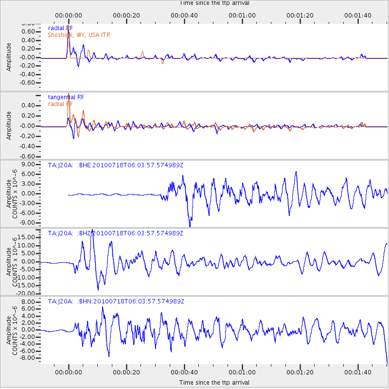
Earthquake location: Fox Islands, Aleutian Islands
Earthquake latitude/longitude: 52.9/-169.8
Earthquake time(UTC): 2010/07/18 (199) 05:56:44 GMT
Earthquake Depth: 14 km
Earthquake Magnitude: 6.3 MB, 6.7 MS, 6.6 MW, 6.6 MW
Earthquake Catalog/Contributor: WHDF/NEIC
Network: TA USArray Transportable Network (new EarthScope stations)
Station: J20A Shoshoni, WY, USA
Lat/Lon: 43.35 N/108.08 W
Elevation: 1500 m
Distance: 41.1 deg
Az: 77.699 deg
Baz: 305.721 deg
Ray Param: 0.0739762
Estimated Moho Depth: 11.25 km
Estimated Crust Vp/Vs: 2.07
Assumed Crust Vp: 6.161 km/s
Estimated Crust Vs: 2.976 km/s
Estimated Crust Poisson's Ratio: 0.35
Radial Match: 85.79576 %
Radial Bump: 340
Transverse Match: 76.6846 %
Transverse Bump: 400
SOD ConfigId: 319893
Insert Time: 2011-01-05 05:43:01.514 +0000
GWidth: 2.5
Max Bumps: 400
Tol: 0.001

Signal To Noise

ChannelStoNSTALTA
TA:J20A: :BHZ:20100718T06:03:57.574989Z23.6964454.2194656E-61.7806323E-7
TA:J20A: :BHN:20100718T06:03:57.574989Z9.0127951.2099287E-61.3424565E-7
TA:J20A: :BHE:20100718T06:03:57.574989Z5.99888048.7070265E-71.451442E-7
Arrivals
Ps2.1 SECOND
PpPs5.3 SECOND
PsPs/PpSs7.4 SECOND