MDND Maddock, ND, USA - Earthquake Result Viewer
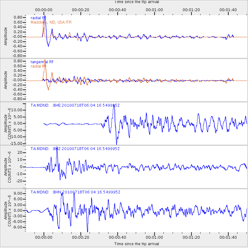
Earthquake location: Fox Islands, Aleutian Islands
Earthquake latitude/longitude: 52.9/-169.8
Earthquake time(UTC): 2010/07/18 (199) 05:56:44 GMT
Earthquake Depth: 14 km
Earthquake Magnitude: 6.3 MB, 6.7 MS, 6.6 MW, 6.6 MW
Earthquake Catalog/Contributor: WHDF/NEIC
Network: TA USArray Transportable Network (new EarthScope stations)
Station: MDND Maddock, ND, USA
Lat/Lon: 47.85 N/99.60 W
Elevation: 479 m
Distance: 43.5 deg
Az: 67.167 deg
Baz: 303.969 deg
Ray Param: 0.072528444
Estimated Moho Depth: 26.25 km
Estimated Crust Vp/Vs: 2.06
Assumed Crust Vp: 6.53 km/s
Estimated Crust Vs: 3.17 km/s
Estimated Crust Poisson's Ratio: 0.35
Radial Match: 94.94704 %
Radial Bump: 343
Transverse Match: 85.72285 %
Transverse Bump: 400
SOD ConfigId: 319893
Insert Time: 2011-01-05 05:44:31.513 +0000
GWidth: 2.5
Max Bumps: 400
Tol: 0.001

Signal To Noise

ChannelStoNSTALTA
TA:MDND: :BHZ:20100718T06:04:16.549995Z28.9828224.905189E-61.692447E-7
TA:MDND: :BHN:20100718T06:04:16.549995Z3.67217161.4666415E-63.9939349E-7
TA:MDND: :BHE:20100718T06:04:16.549995Z6.04670952.1007959E-63.4742794E-7
Arrivals
Ps4.5 SECOND
PpPs12 SECOND
PsPs/PpSs16 SECOND