
SFIN Lafayette, IN, USA - Earthquake Result Viewer
| ||||||||||||||||||
| ||||||||||||||||||
| ||||||||||||||||||
|
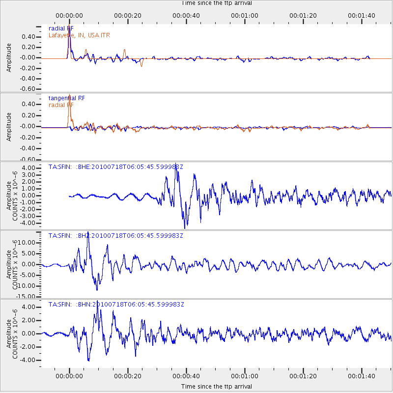
Signal To Noise
| Channel | StoN | STA | LTA |
| TA:SFIN: :BHZ:20100718T06:05:45.599983Z | 8.745231 | 2.9128548E-6 | 3.330792E-7 |
| TA:SFIN: :BHN:20100718T06:05:45.599983Z | 4.231521 | 9.459464E-7 | 2.235476E-7 |
| TA:SFIN: :BHE:20100718T06:05:45.599983Z | 4.5762553 | 1.1303979E-6 | 2.470137E-7 |
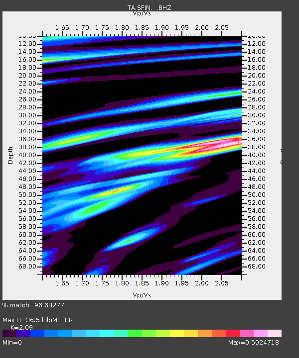
| Arrivals | |
| Ps | 6.4 SECOND |
| PpPs | 17 SECOND |
| PsPs/PpSs | 23 SECOND |

