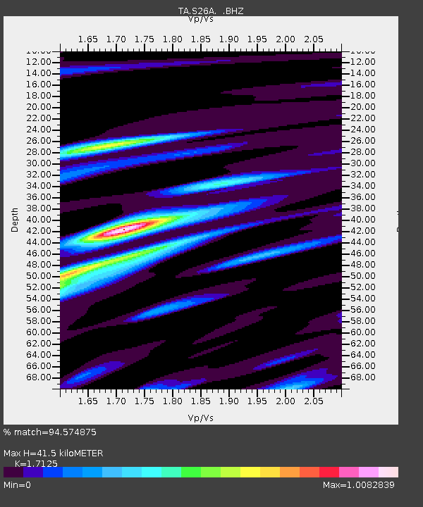
S26A Kim, CO, USA - Earthquake Result Viewer
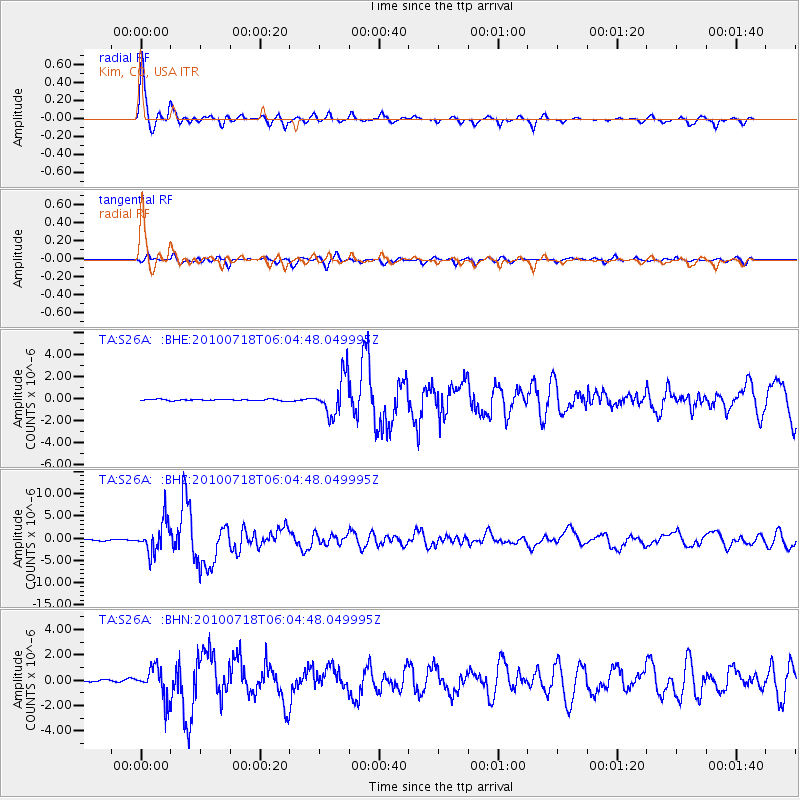
Earthquake location: Fox Islands, Aleutian Islands
Earthquake latitude/longitude: 52.9/-169.8
Earthquake time(UTC): 2010/07/18 (199) 05:56:44 GMT
Earthquake Depth: 14 km
Earthquake Magnitude: 6.3 MB, 6.7 MS, 6.6 MW, 6.6 MW
Earthquake Catalog/Contributor: WHDF/NEIC
Network: TA USArray Transportable Network (new EarthScope stations)
Station: S26A Kim, CO, USA
Lat/Lon: 37.62 N/103.47 W
Elevation: 1394 m
Distance: 47.4 deg
Az: 80.989 deg
Baz: 311.069 deg
Ray Param: 0.06997676
Estimated Moho Depth: 41.5 km
Estimated Crust Vp/Vs: 1.71
Assumed Crust Vp: 6.306 km/s
Estimated Crust Vs: 3.682 km/s
Estimated Crust Poisson's Ratio: 0.24
Radial Match: 94.574875 %
Radial Bump: 352
Transverse Match: 81.671074 %
Transverse Bump: 400
SOD ConfigId: 319893
Insert Time: 2011-01-05 05:47:08.933 +0000
GWidth: 2.5
Max Bumps: 400
Tol: 0.001

Signal To Noise

ChannelStoNSTALTA
TA:S26A: :BHZ:20100718T06:04:48.049995Z29.1015153.5146124E-61.2077076E-7
TA:S26A: :BHN:20100718T06:04:48.049995Z11.6202671.2335724E-61.0615698E-7
TA:S26A: :BHE:20100718T06:04:48.049995Z29.7788221.7770479E-65.967489E-8
Arrivals
Ps5.0 SECOND
PpPs17 SECOND
PsPs/PpSs22 SECOND