V28A Channing, TX, USA - Earthquake Result Viewer
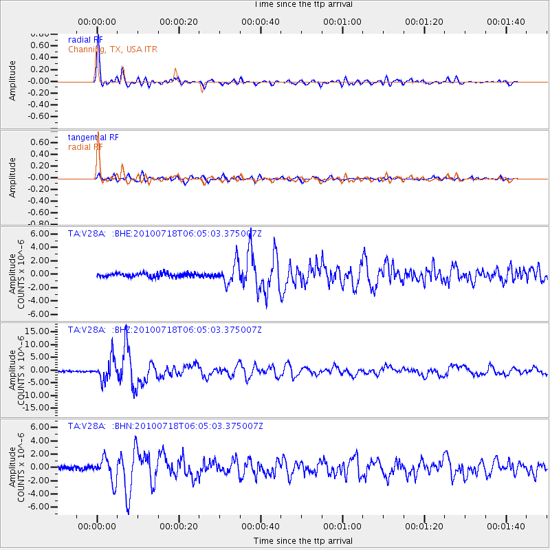
Earthquake location: Fox Islands, Aleutian Islands
Earthquake latitude/longitude: 52.9/-169.8
Earthquake time(UTC): 2010/07/18 (199) 05:56:44 GMT
Earthquake Depth: 14 km
Earthquake Magnitude: 6.3 MB, 6.7 MS, 6.6 MW, 6.6 MW
Earthquake Catalog/Contributor: WHDF/NEIC
Network: TA USArray Transportable Network (new EarthScope stations)
Station: V28A Channing, TX, USA
Lat/Lon: 35.75 N/102.22 W
Elevation: 1163 m
Distance: 49.4 deg
Az: 81.959 deg
Baz: 312.454 deg
Ray Param: 0.06869363
Estimated Moho Depth: 47.25 km
Estimated Crust Vp/Vs: 1.80
Assumed Crust Vp: 6.242 km/s
Estimated Crust Vs: 3.477 km/s
Estimated Crust Poisson's Ratio: 0.27
Radial Match: 95.65133 %
Radial Bump: 400
Transverse Match: 83.29279 %
Transverse Bump: 400
SOD ConfigId: 319893
Insert Time: 2011-01-05 05:47:44.966 +0000
GWidth: 2.5
Max Bumps: 400
Tol: 0.001

Signal To Noise

ChannelStoNSTALTA
TA:V28A: :BHZ:20100718T06:05:03.375007Z19.2566934.3524706E-62.260238E-7
TA:V28A: :BHN:20100718T06:05:03.375007Z9.666891.7964699E-61.8583742E-7
TA:V28A: :BHE:20100718T06:05:03.375007Z5.5112361.6097158E-62.920789E-7
Arrivals
Ps6.4 SECOND
PpPs20 SECOND
PsPs/PpSs26 SECOND