V29A Stinnett, TX, USA - Earthquake Result Viewer
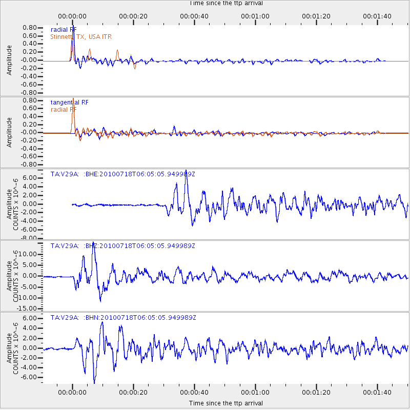
Earthquake location: Fox Islands, Aleutian Islands
Earthquake latitude/longitude: 52.9/-169.8
Earthquake time(UTC): 2010/07/18 (199) 05:56:44 GMT
Earthquake Depth: 14 km
Earthquake Magnitude: 6.3 MB, 6.7 MS, 6.6 MW, 6.6 MW
Earthquake Catalog/Contributor: WHDF/NEIC
Network: TA USArray Transportable Network (new EarthScope stations)
Station: V29A Stinnett, TX, USA
Lat/Lon: 35.87 N/101.52 W
Elevation: 953 m
Distance: 49.8 deg
Az: 81.333 deg
Baz: 312.458 deg
Ray Param: 0.06847814
Estimated Moho Depth: 51.0 km
Estimated Crust Vp/Vs: 1.60
Assumed Crust Vp: 6.426 km/s
Estimated Crust Vs: 4.016 km/s
Estimated Crust Poisson's Ratio: 0.18
Radial Match: 95.85697 %
Radial Bump: 400
Transverse Match: 84.1501 %
Transverse Bump: 400
SOD ConfigId: 319893
Insert Time: 2011-01-05 05:47:50.290 +0000
GWidth: 2.5
Max Bumps: 400
Tol: 0.001

Signal To Noise

ChannelStoNSTALTA
TA:V29A: :BHZ:20100718T06:05:05.949989Z45.329863.9707147E-68.759601E-8
TA:V29A: :BHN:20100718T06:05:05.949989Z13.1606611.8580504E-61.4118214E-7
TA:V29A: :BHE:20100718T06:05:05.949989Z17.8976941.9887505E-61.11117686E-7
Arrivals
Ps5.1 SECOND
PpPs19 SECOND
PsPs/PpSs24 SECOND