You are here: Home > Network List > TA - USArray Transportable Network (new EarthScope stations) Stations List
> Station 429A Davenport Ranch, Sheffield, TX, USA > Earthquake Result Viewer
429A Davenport Ranch, Sheffield, TX, USA - Earthquake Result Viewer

| Earthquake location: |
Fox Islands, Aleutian Islands |
| Earthquake latitude/longitude: |
52.9/-169.8 |
| Earthquake time(UTC): |
2010/07/18 (199) 05:56:44 GMT |
| Earthquake Depth: |
14 km |
| Earthquake Magnitude: |
6.3 MB, 6.7 MS, 6.6 MW, 6.6 MW |
| Earthquake Catalog/Contributor: |
WHDF/NEIC |
|
| Network: |
TA USArray Transportable Network (new EarthScope stations) |
| Station: |
429A Davenport Ranch, Sheffield, TX, USA |
| Lat/Lon: |
30.62 N/101.89 W |
| Elevation: |
804 m |
|
| Distance: |
53.2 deg |
| Az: |
86.428 deg |
| Baz: |
315.43 deg |
| Ray Param: |
0.06626153 |
| Estimated Moho Depth: |
42.5 km |
| Estimated Crust Vp/Vs: |
2.09 |
| Assumed Crust Vp: |
6.38 km/s |
| Estimated Crust Vs: |
3.049 km/s |
| Estimated Crust Poisson's Ratio: |
0.35 |
|
| Radial Match: |
92.60139 % |
| Radial Bump: |
392 |
| Transverse Match: |
86.84631 % |
| Transverse Bump: |
400 |
| SOD ConfigId: |
319893 |
| Insert Time: |
2011-01-05 05:49:31.186 +0000 |
| GWidth: |
2.5 |
| Max Bumps: |
400 |
| Tol: |
0.001 |
|
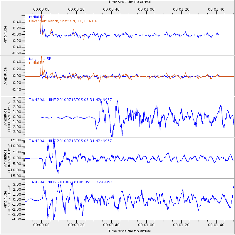
Signal To Noise
| Channel | StoN | STA | LTA |
| TA:429A: :BHZ:20100718T06:05:31.424995Z | 49.56064 | 5.269713E-6 | 1.0632859E-7 |
| TA:429A: :BHN:20100718T06:05:31.424995Z | 11.794127 | 1.708959E-6 | 1.4489915E-7 |
| TA:429A: :BHE:20100718T06:05:31.424995Z | 14.694156 | 1.7121887E-6 | 1.1652175E-7 |
| Arrivals |
| Ps | 7.6 SECOND |
| PpPs | 20 SECOND |
| PsPs/PpSs | 27 SECOND |


