230A Sterling City, TX, USA - Earthquake Result Viewer
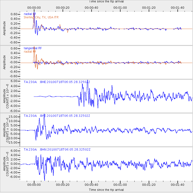
Earthquake location: Fox Islands, Aleutian Islands
Earthquake latitude/longitude: 52.9/-169.8
Earthquake time(UTC): 2010/07/18 (199) 05:56:44 GMT
Earthquake Depth: 14 km
Earthquake Magnitude: 6.3 MB, 6.7 MS, 6.6 MW, 6.6 MW
Earthquake Catalog/Contributor: WHDF/NEIC
Network: TA USArray Transportable Network (new EarthScope stations)
Station: 230A Sterling City, TX, USA
Lat/Lon: 31.89 N/101.11 W
Elevation: 742 m
Distance: 52.8 deg
Az: 84.721 deg
Baz: 314.806 deg
Ray Param: 0.06654242
Estimated Moho Depth: 16.0 km
Estimated Crust Vp/Vs: 1.65
Assumed Crust Vp: 6.38 km/s
Estimated Crust Vs: 3.873 km/s
Estimated Crust Poisson's Ratio: 0.21
Radial Match: 95.861664 %
Radial Bump: 400
Transverse Match: 82.42847 %
Transverse Bump: 400
SOD ConfigId: 319893
Insert Time: 2011-01-05 05:50:23.013 +0000
GWidth: 2.5
Max Bumps: 400
Tol: 0.001

Signal To Noise

ChannelStoNSTALTA
TA:230A: :BHZ:20100718T06:05:28.32502Z49.286565.7033044E-61.15717235E-7
TA:230A: :BHN:20100718T06:05:28.32502Z24.580292.337465E-69.5095096E-8
TA:230A: :BHE:20100718T06:05:28.32502Z24.1029282.2121656E-69.177995E-8
Arrivals
Ps1.7 SECOND
PpPs6.3 SECOND
PsPs/PpSs8.0 SECOND