
332A Millersview, TX, USA - Earthquake Result Viewer
| ||||||||||||||||||
| ||||||||||||||||||
| ||||||||||||||||||
|
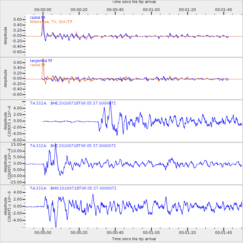
Signal To Noise
| Channel | StoN | STA | LTA |
| TA:332A: :BHZ:20100718T06:05:37.000007Z | 50.92542 | 4.7658227E-6 | 9.358436E-8 |
| TA:332A: :BHN:20100718T06:05:37.000007Z | 27.241686 | 1.7681189E-6 | 6.4904896E-8 |
| TA:332A: :BHE:20100718T06:05:37.000007Z | 18.878185 | 1.8574354E-6 | 9.839057E-8 |
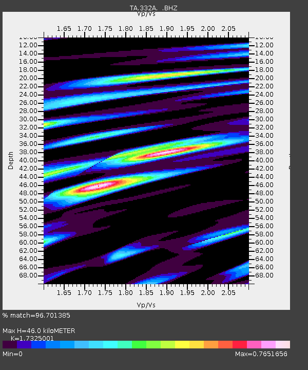
| Arrivals | |
| Ps | 5.5 SECOND |
| PpPs | 18 SECOND |
| PsPs/PpSs | 24 SECOND |

