232A Coleman, TX, USA - Earthquake Result Viewer
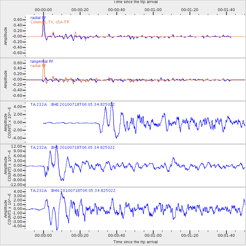
Earthquake location: Fox Islands, Aleutian Islands
Earthquake latitude/longitude: 52.9/-169.8
Earthquake time(UTC): 2010/07/18 (199) 05:56:44 GMT
Earthquake Depth: 14 km
Earthquake Magnitude: 6.3 MB, 6.7 MS, 6.6 MW, 6.6 MW
Earthquake Catalog/Contributor: WHDF/NEIC
Network: TA USArray Transportable Network (new EarthScope stations)
Station: 232A Coleman, TX, USA
Lat/Lon: 31.89 N/99.65 W
Elevation: 621 m
Distance: 53.6 deg
Az: 83.622 deg
Baz: 314.919 deg
Ray Param: 0.06595073
Estimated Moho Depth: 50.5 km
Estimated Crust Vp/Vs: 1.64
Assumed Crust Vp: 6.498 km/s
Estimated Crust Vs: 3.95 km/s
Estimated Crust Poisson's Ratio: 0.21
Radial Match: 97.01378 %
Radial Bump: 280
Transverse Match: 85.204475 %
Transverse Bump: 400
SOD ConfigId: 319893
Insert Time: 2011-01-05 05:50:44.956 +0000
GWidth: 2.5
Max Bumps: 400
Tol: 0.001

Signal To Noise

ChannelStoNSTALTA
TA:232A: :BHZ:20100718T06:05:34.82502Z51.518984.3247055E-68.3943924E-8
TA:232A: :BHN:20100718T06:05:34.82502Z17.4382461.7533075E-61.005438E-7
TA:232A: :BHE:20100718T06:05:34.82502Z24.2771931.922071E-67.917188E-8
Arrivals
Ps5.3 SECOND
PpPs19 SECOND
PsPs/PpSs25 SECOND