130A Snyder, TX, USA - Earthquake Result Viewer
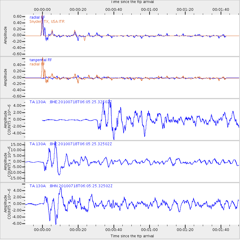
Earthquake location: Fox Islands, Aleutian Islands
Earthquake latitude/longitude: 52.9/-169.8
Earthquake time(UTC): 2010/07/18 (199) 05:56:44 GMT
Earthquake Depth: 14 km
Earthquake Magnitude: 6.3 MB, 6.7 MS, 6.6 MW, 6.6 MW
Earthquake Catalog/Contributor: WHDF/NEIC
Network: TA USArray Transportable Network (new EarthScope stations)
Station: 130A Snyder, TX, USA
Lat/Lon: 32.60 N/100.97 W
Elevation: 676 m
Distance: 52.4 deg
Az: 83.977 deg
Baz: 314.432 deg
Ray Param: 0.06680293
Estimated Moho Depth: 45.75 km
Estimated Crust Vp/Vs: 1.73
Assumed Crust Vp: 6.426 km/s
Estimated Crust Vs: 3.715 km/s
Estimated Crust Poisson's Ratio: 0.25
Radial Match: 97.154655 %
Radial Bump: 342
Transverse Match: 85.677345 %
Transverse Bump: 400
SOD ConfigId: 319893
Insert Time: 2011-01-05 05:51:17.016 +0000
GWidth: 2.5
Max Bumps: 400
Tol: 0.001

Signal To Noise

ChannelStoNSTALTA
TA:130A: :BHZ:20100718T06:05:25.32502Z30.44485.1276447E-61.6842432E-7
TA:130A: :BHN:20100718T06:05:25.32502Z16.9449631.9046762E-61.12403676E-7
TA:130A: :BHE:20100718T06:05:25.32502Z21.2142722.1028854E-69.912597E-8
Arrivals
Ps5.5 SECOND
PpPs18 SECOND
PsPs/PpSs24 SECOND