
S28A Manter, KS, USA - Earthquake Result Viewer
| ||||||||||||||||||
| ||||||||||||||||||
| ||||||||||||||||||
|
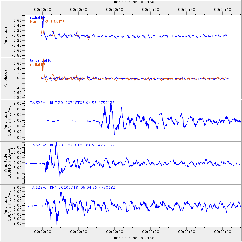
Signal To Noise
| Channel | StoN | STA | LTA |
| TA:S28A: :BHZ:20100718T06:04:55.475013Z | 53.463375 | 5.0599115E-6 | 9.4642566E-8 |
| TA:S28A: :BHN:20100718T06:04:55.475013Z | 19.152575 | 2.0314892E-6 | 1.06068725E-7 |
| TA:S28A: :BHE:20100718T06:04:55.475013Z | 25.599014 | 2.48925E-6 | 9.7240076E-8 |
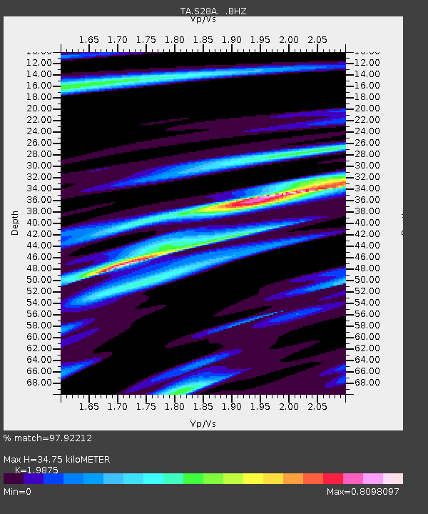
| Arrivals | |
| Ps | 5.6 SECOND |
| PpPs | 15 SECOND |
| PsPs/PpSs | 21 SECOND |

