
S31A Mullinville, KS, USA - Earthquake Result Viewer
| ||||||||||||||||||
| ||||||||||||||||||
| ||||||||||||||||||
|
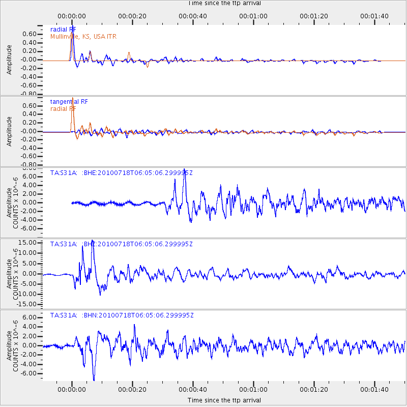
Signal To Noise
| Channel | StoN | STA | LTA |
| TA:S31A: :BHZ:20100718T06:05:06.299995Z | 27.7567 | 4.3565465E-6 | 1.5695478E-7 |
| TA:S31A: :BHN:20100718T06:05:06.299995Z | 8.412652 | 1.5651059E-6 | 1.860419E-7 |
| TA:S31A: :BHE:20100718T06:05:06.299995Z | 6.5244455 | 1.6827732E-6 | 2.579182E-7 |
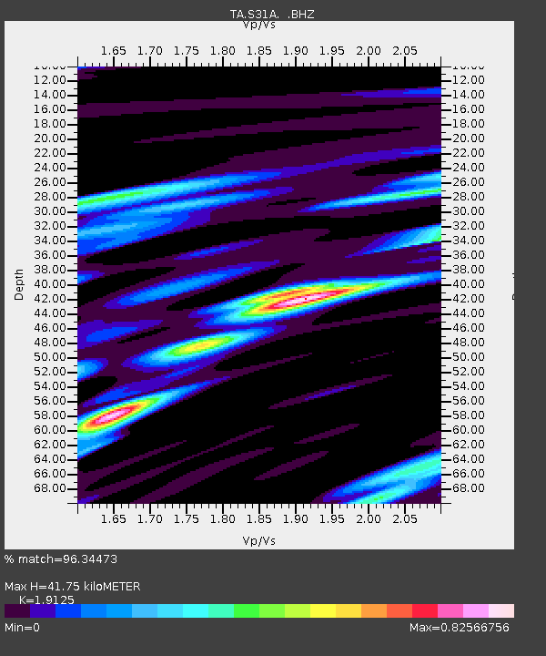
| Arrivals | |
| Ps | 6.3 SECOND |
| PpPs | 18 SECOND |
| PsPs/PpSs | 24 SECOND |

