D27A Center, ND, USA - Earthquake Result Viewer
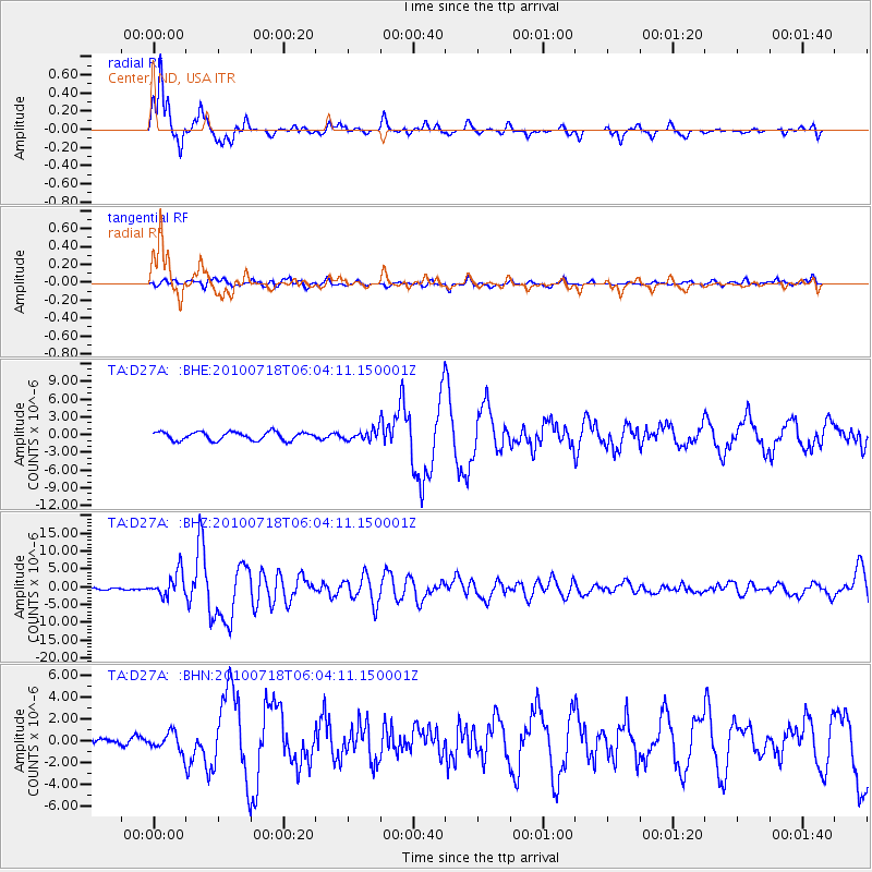
Earthquake location: Fox Islands, Aleutian Islands
Earthquake latitude/longitude: 52.9/-169.8
Earthquake time(UTC): 2010/07/18 (199) 05:56:44 GMT
Earthquake Depth: 14 km
Earthquake Magnitude: 6.3 MB, 6.7 MS, 6.6 MW, 6.6 MW
Earthquake Catalog/Contributor: WHDF/NEIC
Network: TA USArray Transportable Network (new EarthScope stations)
Station: D27A Center, ND, USA
Lat/Lon: 47.11 N/101.53 W
Elevation: 685 m
Distance: 42.8 deg
Az: 69.131 deg
Baz: 303.99 deg
Ray Param: 0.0729528
Estimated Moho Depth: 22.25 km
Estimated Crust Vp/Vs: 1.62
Assumed Crust Vp: 6.438 km/s
Estimated Crust Vs: 3.968 km/s
Estimated Crust Poisson's Ratio: 0.19
Radial Match: 87.51127 %
Radial Bump: 345
Transverse Match: 56.91144 %
Transverse Bump: 400
SOD ConfigId: 319893
Insert Time: 2011-01-05 05:56:28.265 +0000
GWidth: 2.5
Max Bumps: 400
Tol: 0.001

Signal To Noise

ChannelStoNSTALTA
TA:D27A: :BHZ:20100718T06:04:11.150001Z16.1419733.4097077E-62.1123239E-7
TA:D27A: :BHN:20100718T06:04:11.150001Z2.79458938.556291E-73.0617346E-7
TA:D27A: :BHE:20100718T06:04:11.150001Z1.20139738.4607586E-77.042432E-7
Arrivals
Ps2.3 SECOND
PpPs8.4 SECOND
PsPs/PpSs11 SECOND