F27A Lemmon, SD, USA - Earthquake Result Viewer
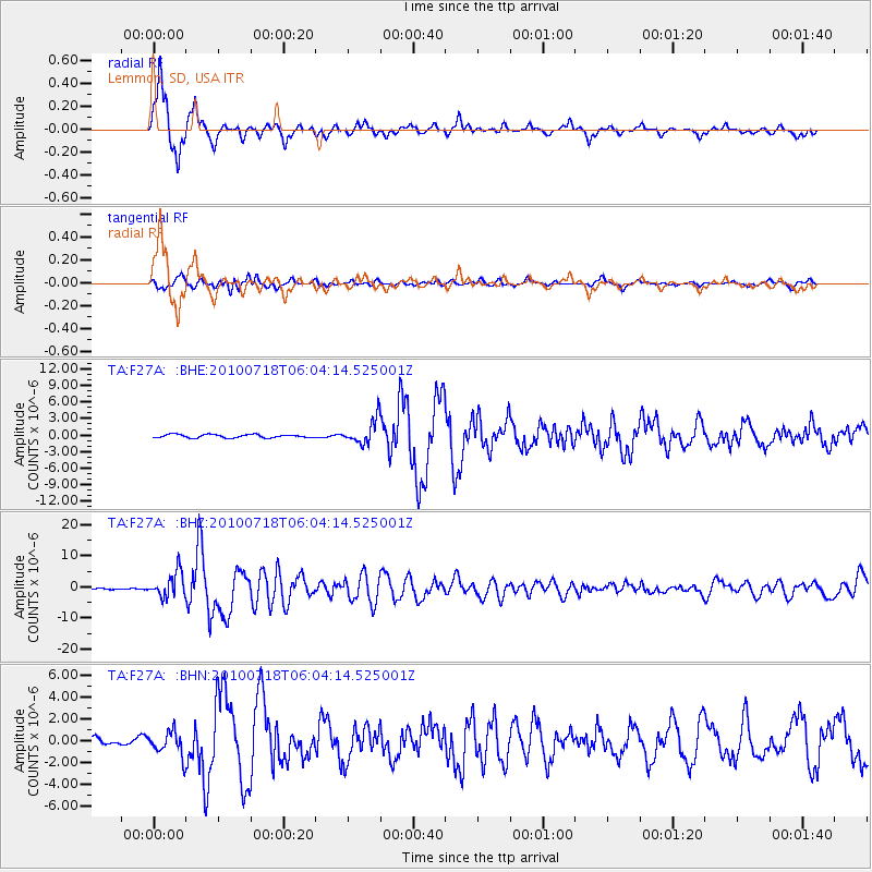
Earthquake location: Fox Islands, Aleutian Islands
Earthquake latitude/longitude: 52.9/-169.8
Earthquake time(UTC): 2010/07/18 (199) 05:56:44 GMT
Earthquake Depth: 14 km
Earthquake Magnitude: 6.3 MB, 6.7 MS, 6.6 MW, 6.6 MW
Earthquake Catalog/Contributor: WHDF/NEIC
Network: TA USArray Transportable Network (new EarthScope stations)
Station: F27A Lemmon, SD, USA
Lat/Lon: 45.87 N/102.02 W
Elevation: 757 m
Distance: 43.2 deg
Az: 70.909 deg
Baz: 304.933 deg
Ray Param: 0.072689265
Estimated Moho Depth: 19.5 km
Estimated Crust Vp/Vs: 1.60
Assumed Crust Vp: 6.242 km/s
Estimated Crust Vs: 3.901 km/s
Estimated Crust Poisson's Ratio: 0.18
Radial Match: 94.75138 %
Radial Bump: 347
Transverse Match: 70.61995 %
Transverse Bump: 400
SOD ConfigId: 319893
Insert Time: 2011-01-05 05:56:36.778 +0000
GWidth: 2.5
Max Bumps: 400
Tol: 0.001

Signal To Noise

ChannelStoNSTALTA
TA:F27A: :BHZ:20100718T06:04:14.525001Z27.738713.983054E-61.4359189E-7
TA:F27A: :BHN:20100718T06:04:14.525001Z3.18086431.0950528E-63.4426265E-7
TA:F27A: :BHE:20100718T06:04:14.525001Z7.45597362.2372178E-63.0005708E-7
Arrivals
Ps2.0 SECOND
PpPs7.6 SECOND
PsPs/PpSs9.6 SECOND