D28A Regan, ND, USA - Earthquake Result Viewer
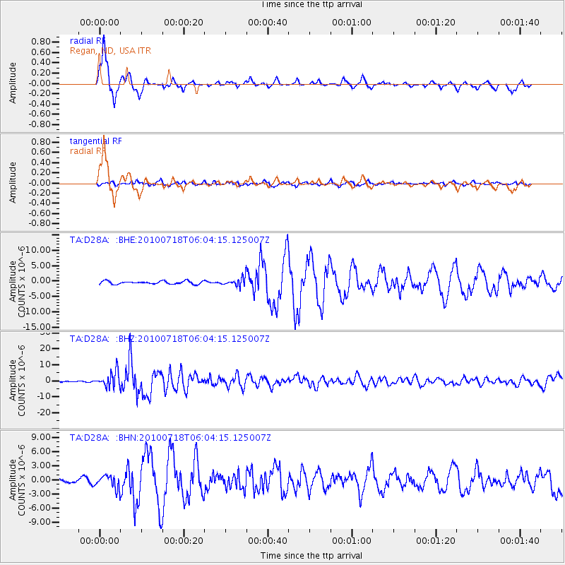
Earthquake location: Fox Islands, Aleutian Islands
Earthquake latitude/longitude: 52.9/-169.8
Earthquake time(UTC): 2010/07/18 (199) 05:56:44 GMT
Earthquake Depth: 14 km
Earthquake Magnitude: 6.3 MB, 6.7 MS, 6.6 MW, 6.6 MW
Earthquake Catalog/Contributor: WHDF/NEIC
Network: TA USArray Transportable Network (new EarthScope stations)
Station: D28A Regan, ND, USA
Lat/Lon: 47.19 N/100.57 W
Elevation: 621 m
Distance: 43.3 deg
Az: 68.492 deg
Baz: 304.222 deg
Ray Param: 0.07264081
Estimated Moho Depth: 20.0 km
Estimated Crust Vp/Vs: 1.61
Assumed Crust Vp: 6.438 km/s
Estimated Crust Vs: 4.011 km/s
Estimated Crust Poisson's Ratio: 0.18
Radial Match: 81.33447 %
Radial Bump: 292
Transverse Match: 60.28982 %
Transverse Bump: 400
SOD ConfigId: 319893
Insert Time: 2011-01-05 05:57:12.671 +0000
GWidth: 2.5
Max Bumps: 400
Tol: 0.001

Signal To Noise

ChannelStoNSTALTA
TA:D28A: :BHZ:20100718T06:04:15.125007Z27.4936544.8160673E-61.7517014E-7
TA:D28A: :BHN:20100718T06:04:15.125007Z3.0145541.3911637E-64.614824E-7
TA:D28A: :BHE:20100718T06:04:15.125007Z2.90742751.4144257E-64.86487E-7
Arrivals
Ps2.0 SECOND
PpPs7.5 SECOND
PsPs/PpSs9.5 SECOND