E28A Huff, ND, USA - Earthquake Result Viewer
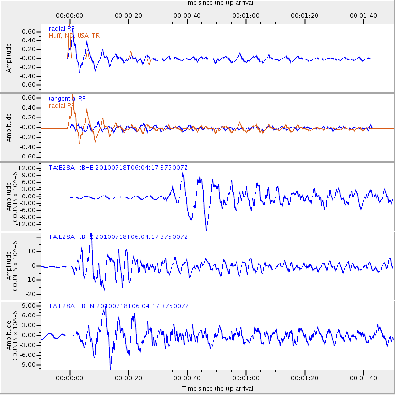
Earthquake location: Fox Islands, Aleutian Islands
Earthquake latitude/longitude: 52.9/-169.8
Earthquake time(UTC): 2010/07/18 (199) 05:56:44 GMT
Earthquake Depth: 14 km
Earthquake Magnitude: 6.3 MB, 6.7 MS, 6.6 MW, 6.6 MW
Earthquake Catalog/Contributor: WHDF/NEIC
Network: TA USArray Transportable Network (new EarthScope stations)
Station: E28A Huff, ND, USA
Lat/Lon: 46.57 N/100.69 W
Elevation: 579 m
Distance: 43.6 deg
Az: 69.304 deg
Baz: 304.721 deg
Ray Param: 0.07246069
Estimated Moho Depth: 18.0 km
Estimated Crust Vp/Vs: 1.65
Assumed Crust Vp: 6.438 km/s
Estimated Crust Vs: 3.89 km/s
Estimated Crust Poisson's Ratio: 0.21
Radial Match: 85.83868 %
Radial Bump: 271
Transverse Match: 76.83461 %
Transverse Bump: 400
SOD ConfigId: 319893
Insert Time: 2011-01-05 05:57:57.680 +0000
GWidth: 2.5
Max Bumps: 400
Tol: 0.001

Signal To Noise

ChannelStoNSTALTA
TA:E28A: :BHZ:20100718T06:04:17.375007Z17.744664.28594E-62.4153408E-7
TA:E28A: :BHN:20100718T06:04:17.375007Z1.74980279.137233E-75.2218644E-7
TA:E28A: :BHE:20100718T06:04:17.375007Z2.3629561.1021694E-64.6643672E-7
Arrivals
Ps2.0 SECOND
PpPs6.9 SECOND
PsPs/PpSs8.9 SECOND