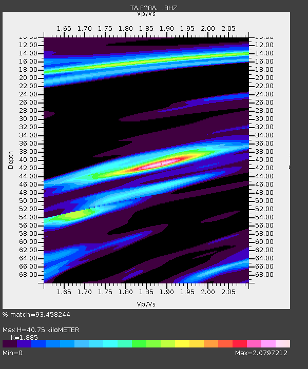
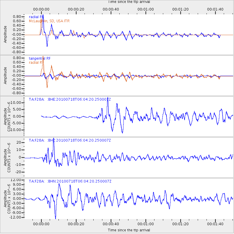
F28A McLaughlin, SD, USA - Earthquake Result Viewer

Earthquake location: Fox Islands, Aleutian Islands
Earthquake latitude/longitude: 52.9/-169.8
Earthquake time(UTC): 2010/07/18 (199) 05:56:44 GMT
Earthquake Depth: 14 km
Earthquake Magnitude: 6.3 MB, 6.7 MS, 6.6 MW, 6.6 MW
Earthquake Catalog/Contributor: WHDF/NEIC
Network: TA USArray Transportable Network (new EarthScope stations)
Station: F28A McLaughlin, SD, USA
Lat/Lon: 45.85 N/100.80 W
Elevation: 633 m
Distance: 43.9 deg
Az: 70.226 deg
Baz: 305.31 deg
Ray Param: 0.07222772
Estimated Moho Depth: 40.75 km
Estimated Crust Vp/Vs: 1.88
Assumed Crust Vp: 6.53 km/s
Estimated Crust Vs: 3.464 km/s
Estimated Crust Poisson's Ratio: 0.30
Radial Match: 93.458244 %
Radial Bump: 345
Transverse Match: 86.10796 %
Transverse Bump: 400
SOD ConfigId: 319893
Insert Time: 2011-01-05 05:58:43.741 +0000
GWidth: 2.5
Max Bumps: 400
Tol: 0.001

Signal To Noise

ChannelStoNSTALTA
TA:F28A: :BHZ:20100718T06:04:20.250007Z33.330814.7952967E-61.438698E-7
TA:F28A: :BHN:20100718T06:04:20.250007Z3.14145421.5276364E-64.862832E-7
TA:F28A: :BHE:20100718T06:04:20.250007Z4.0049691.721119E-64.2974588E-7
Arrivals
Ps5.9 SECOND
PpPs17 SECOND
PsPs/PpSs23 SECOND